July 24, 2016
I awoke the next morning, relieved that I hadn't had a drunken visitor in the night.
Canada Creek

Just as I left it started to rain.

I came to the first major road crossing on the High Country Pathway at M-33.


I stopped and got some water from Tomahawk Creek.


Then I came to Shoepac Lake for the first time.

Shoepac Lake


Shoepac Lake almost feels like several different lakes.


The lake didn't feel that wild as there were buildings on the other side.

I walked along the road and passed the Sink Holes Trailhead.

I reached Shoepac Lake Campground and went to find the water pump.


The trail went through some prior logging areas.


There was a spur trail to the Tomahawk Lake State Forest Campground but I continued on the HCP.

Soon I reached the Tomahawk Creek Flooding.


The trail went away from the water for some time.


Then it returned to Tomahawk Creek Flooding.


I went out to a point for a final view. There were lots of dead trees in the water.


Then there was a hot hike on a two-track.

Next there was an actual road walk.


Near the road there was a water source.

Back on the trail through some open areas.


There were more berries to eat.


The trail went back in the forest.

The trail was overgrown with ferns.


I reached the Valentine Branch of the Detroit and Mackinac Railroad.

I could see a tower and thought that must mean I was close to Tower Road.

Tower Road


I reached a junction and decided to take the trail to Clear Lake State Park instead of the HCP.


Clear Lake


The state park was busy with quite a few people on the beach. It was a drastic change from the isolation of the HCP.
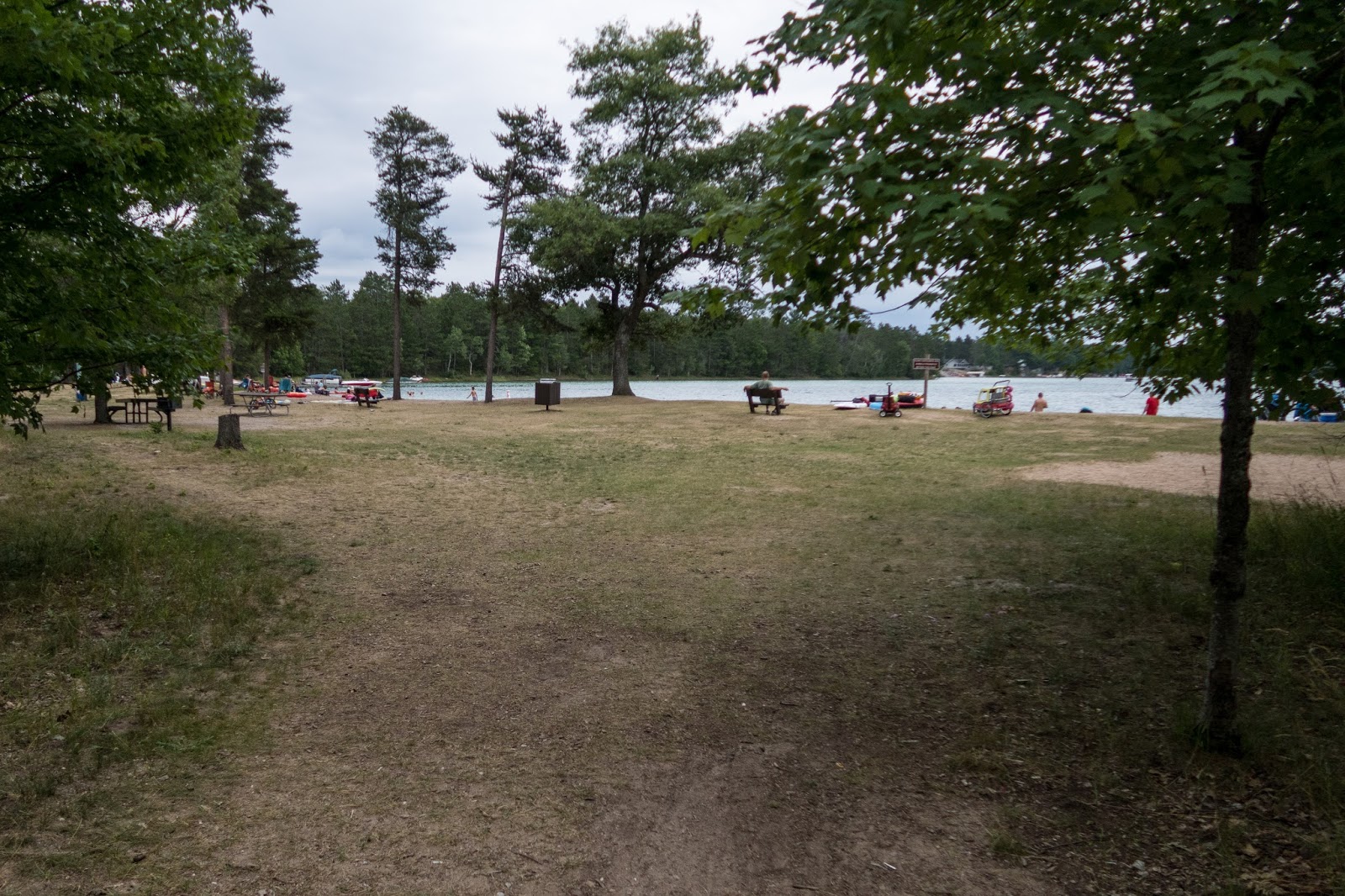

It was a scenic lake though.


I saw a sign indicating the HCP but wasn't sure if it was the HCP going in the opposite direction. All the trail are marked with the same blue markers.

I continued the other way and discovered it was the wrong trail, the Nature Trail.


The trail did bring me to Canada Creek and the HCP crossed it later.

The creek was shallow in the spot so I decided to walk in it to connect with HCP. This resulted in walking through some people's back yards and they were surprised to see me walking by.

It didn't take long and I was at the bridge and the HCP was just a road walk here.

After the road walk, I was back on the trail. I did miss a spot where the trail turned off near this field.

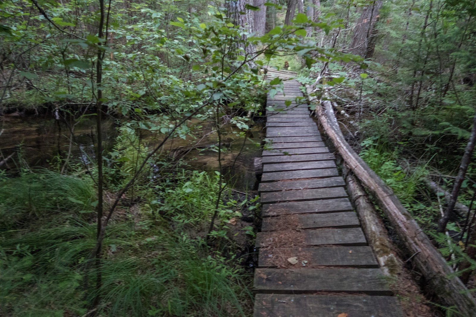
There was a nice bridge over a beautiful forested stream.


This area almost felt like the U.P.
Then the trail went back into some forested areas.

I could see a ridge in the distance.


I could hear a loud noise through the trees.

I began the climb up Rattlesnake Hill.


I came up to the first summit and the view was limited.

The trail descended a little and then climbed back up.

The view from Rattlesnake Hill is one of my favorites in the Lower Peninsula.

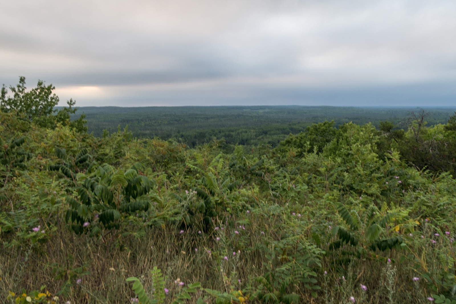
There was a bench on top and I enjoyed the view.

I set up camp near the bench and had a relaxing evening.

There were some impressive clouds.


Campsite on Rattlesnake Hill


Hi Eric,
ReplyDeleteGreat pics and info! I hope to get there this summer! Cheers, Meggan
Thanks Meggan!
Delete