Miles: ~35 miles
Highlights: Hodenpyl Dam Pond, Numerous overlooks of the Manistee River, Highbanks Rollaway, fall colors
Of all the national scenic trails, I have currently hiked the most miles on the North Country Trail, a 4600 mile trail from North Dakota to New York (soon Vermont). Whether it be beautiful segments in the Boundary Waters Canoe Area Wilderness (Border Route Trail, Kekekabic Trail), along Lake Superior's beautiful shoreline (Superior Hiking Trail, Pictured Rocks National Lakeshore), or in Michigan's Lower Peninsula (Manistee River, Jordan River Pathway), the NCT has provided exceptional backpacking opportunities.
This was the last section of the NCT between Croton and the Mackinaw Bridge. I saved it for the fall as I anticipated it being excellent with the colors. It certainly did not disappoint. I completed this as part of a weekend hike including the Manistee River Trail.
I joined the NCT at the northern NCT/MRT junction after having just completed the MRT. (see here: Manistee River Trail)

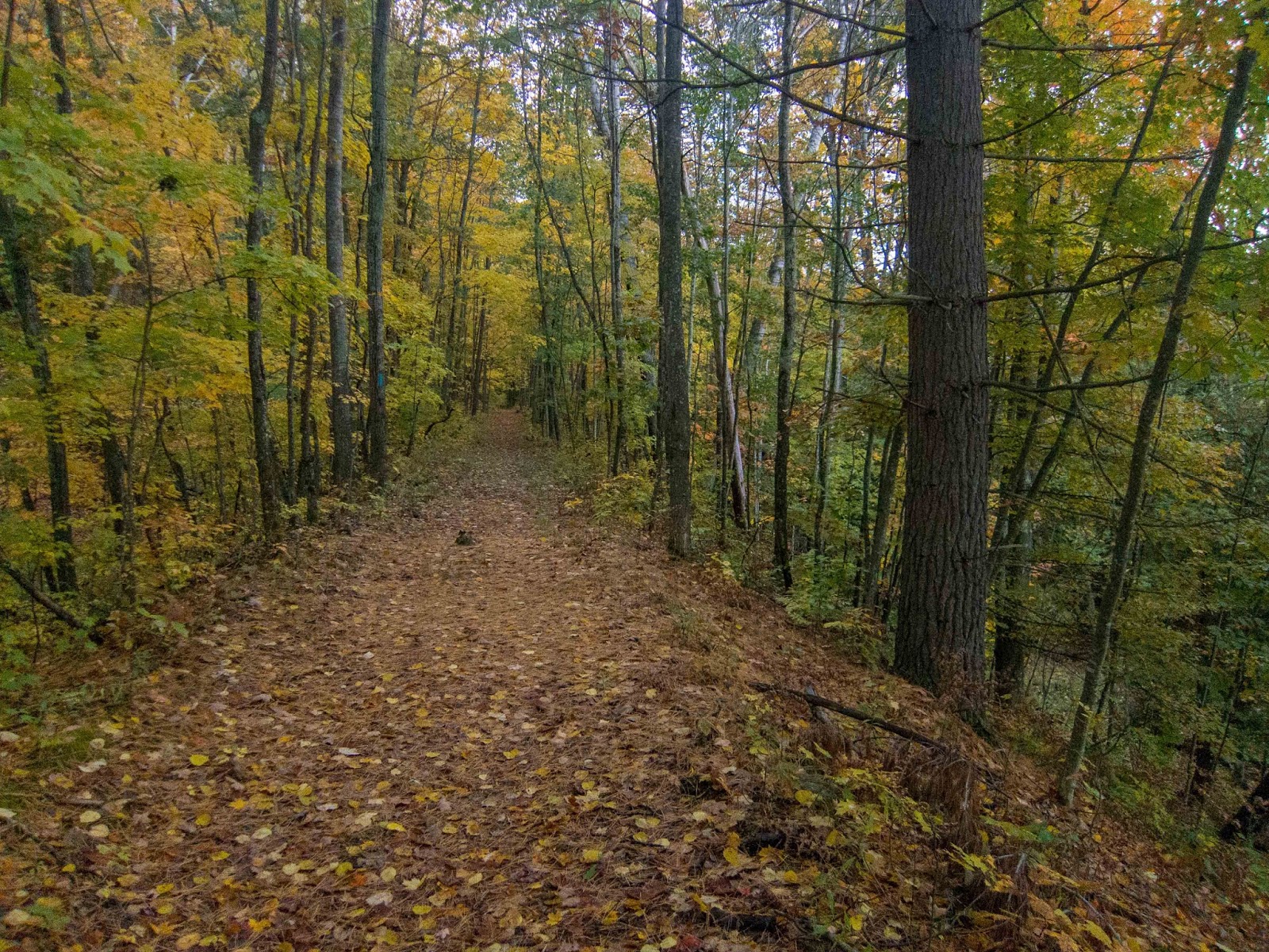
I made my way north on a wide and level trail.

Soon I reached the trailhead on Hodenpyl Dam Road and started a short road walk.

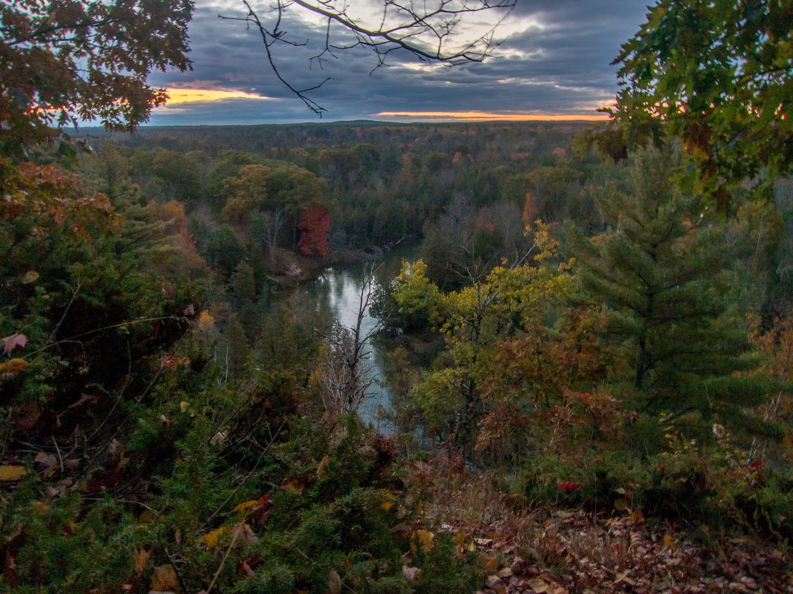
Then it was back to the forest for a great section of trail.

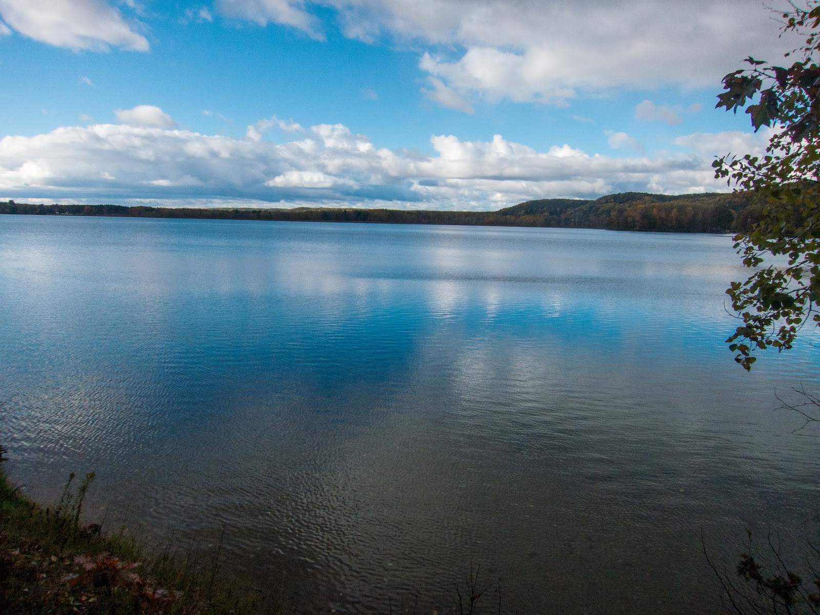
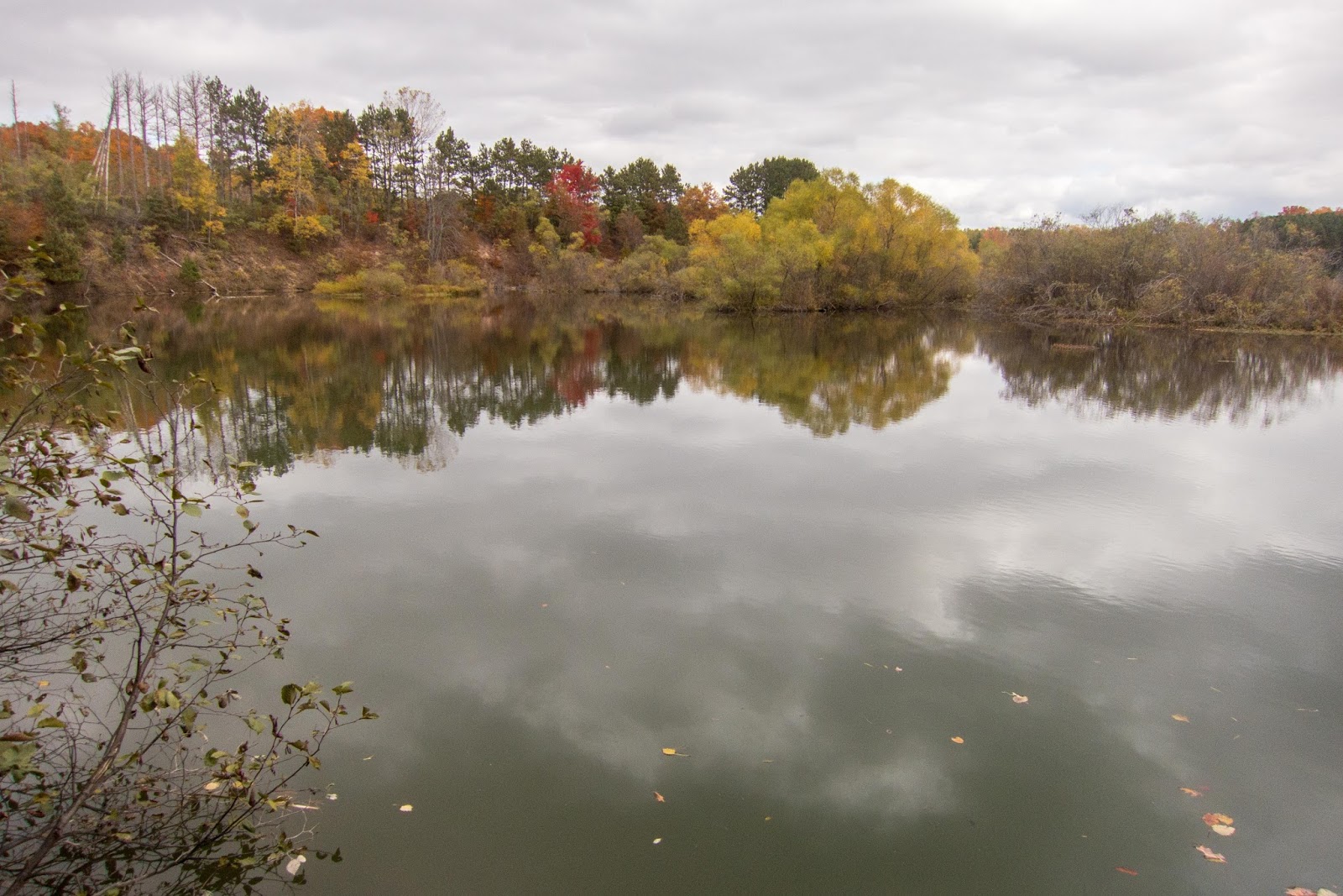
The trail stays close to the shore of Hodenpyl Dam Pond, which is actually the Manistee River. There were geese flying overhead and ducks down below.


This was one of my favorite sections of trail.


There was a bench to sit back and enjoy the view!


The clouds began to darken.

I took a panorama to try to capture the size of Hodenpyl Dam Pond.


A scenic boardwalk.


I took a quick detour to explore North Exposure Campground. It was closed for the season.

Back on the trail, there were some other trails in the area.

I reached the Northern Exposure Trailhead.


Back on the trail, the scenery near Hodenpyl Dam Pond continued.


The trail was under some powerlines but still quite scenic.


I saw a spur trail to a campsite.

It was for the Fletcher Creek backcountry campsite.


The trail goes right through the Fletcher Creek Campground. It was empty except for the campground host and a barking dog.


After leaving the campground, it was a short roadwalk then back to even more scenery of Hodenpyl Dam Pond.


There were even some overlooking views.


Soon the trail turned away from Hodenpyl Dam Pond for the final time. As I hiked the the trees, I noticed a person on the side of the trail in camouflage. He looked surprised to see me. I said "Hi" and continued on.
The trail crossed M-115 and I walked a short distance to the bridge over the Manistee River.

I returned to the trail with many exciting views.


I took a short spur trail to Arlen's Lookout.

Arlen's Lookout


Back on the trail the views continued.


This section was exciting. It was quite similar to the Manistee River Trail, but there was no one else around.


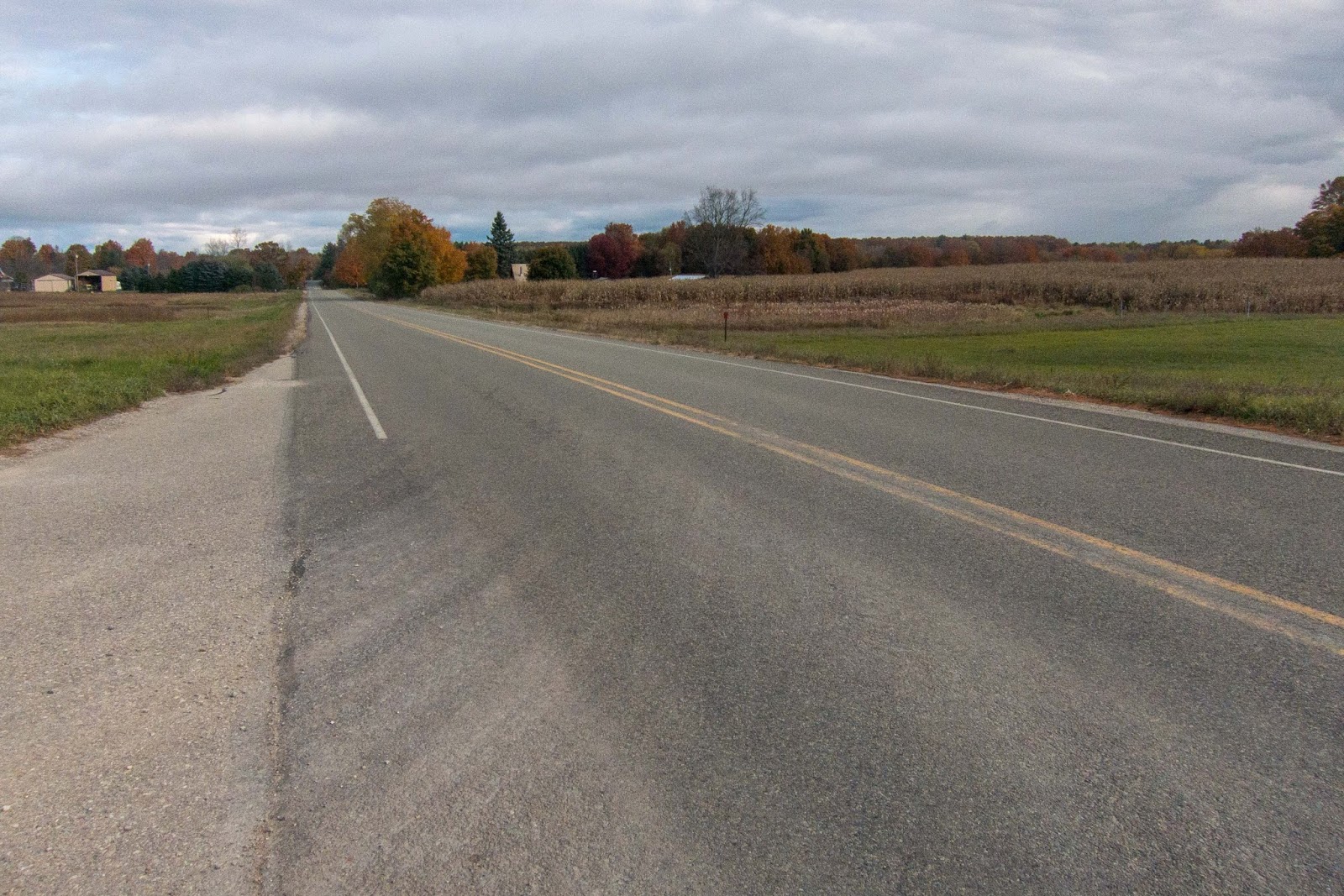
I came out to W 14 Road and had a short road walk through Glengary.

I crossed over the Manistee River.


Then the trail joined an old road.

There was an island in the river.

Some logging activity was evident but they saved the NCT's blue blazed tree.


I reached M-37 and started a lengthier road walk.


The road walk went through Sherman and then crossed the Manistee River.


I turned on W 12 Road which became a remote dirt road.

I reached the parking at 12 and 15 roads.


Soon I was back hiking the bluffs above the river.


The trail was along a nice creek.


One spot even had stairs and a railing.


I reached Harvey Bridge.

There was a fire ring by the river.


There was a bench nearby and I took a break.


I found an interesting marker for a Cadillac to Traverse City route and along a dog's grave marker.

The trail provided glimpses of expansive views in the distance.


I came to Anderson Creek and there was supposed to be a campsite nearby. I considered calling it a day.

When I got there I found another couple out car camping. I said "Hi" and continued on. There was still quite a bit of day light.

In this area the trail follows along a forest road right beside the river. There were other for the weekend camping.

In one spot I walked right through a huge camp set-up. There was a fire going but no one was there. Also there was a giant pile of shot gun shells.


The trail continued along the river.

There was great evening light on the fall colors.


The trail came out and joined the road on a bluff. I decided to set-up camp, hoping the road wouldn't be too busy. It was a beautiful evening.

One of my favorite places I camped on the NCT in lower Michigan.


It was a chilly night, and a couple vehicles went by, but I slept well. I woke up early and began my journey to Highbanks Rollaway. I passed a woman who had set up camp with her horse.

There were some impressive early morning views.


The sun rose through the trees.


I came to a towering overlook.


I took a break as I wasn't sure if this was the Rollaway or not.


Then I came to even bigger views.

The Rollaway was still to come!


I made it to the Highbanks Rollaway and I met a few hikers out taking pictures.
Highbanks Rollaway

The Rollaway has an impressive observation platform.

I didn't have much time so I had to continue on.

Soon I started the next road walk on No 29 1/2 Road.
Then I was back on the trail which was a gaited road near Dell Road.

The trail crossed a scenic creek.

Then I was back at the Manistee River.


This was another special section of trail along the Manistee River. In one spot I found a backcountry campsite that wasn't on the online map. The trail had been re-routed a little in the area.


I came to a lookout platform at the trailhead off a dirt road off Country Line Road.


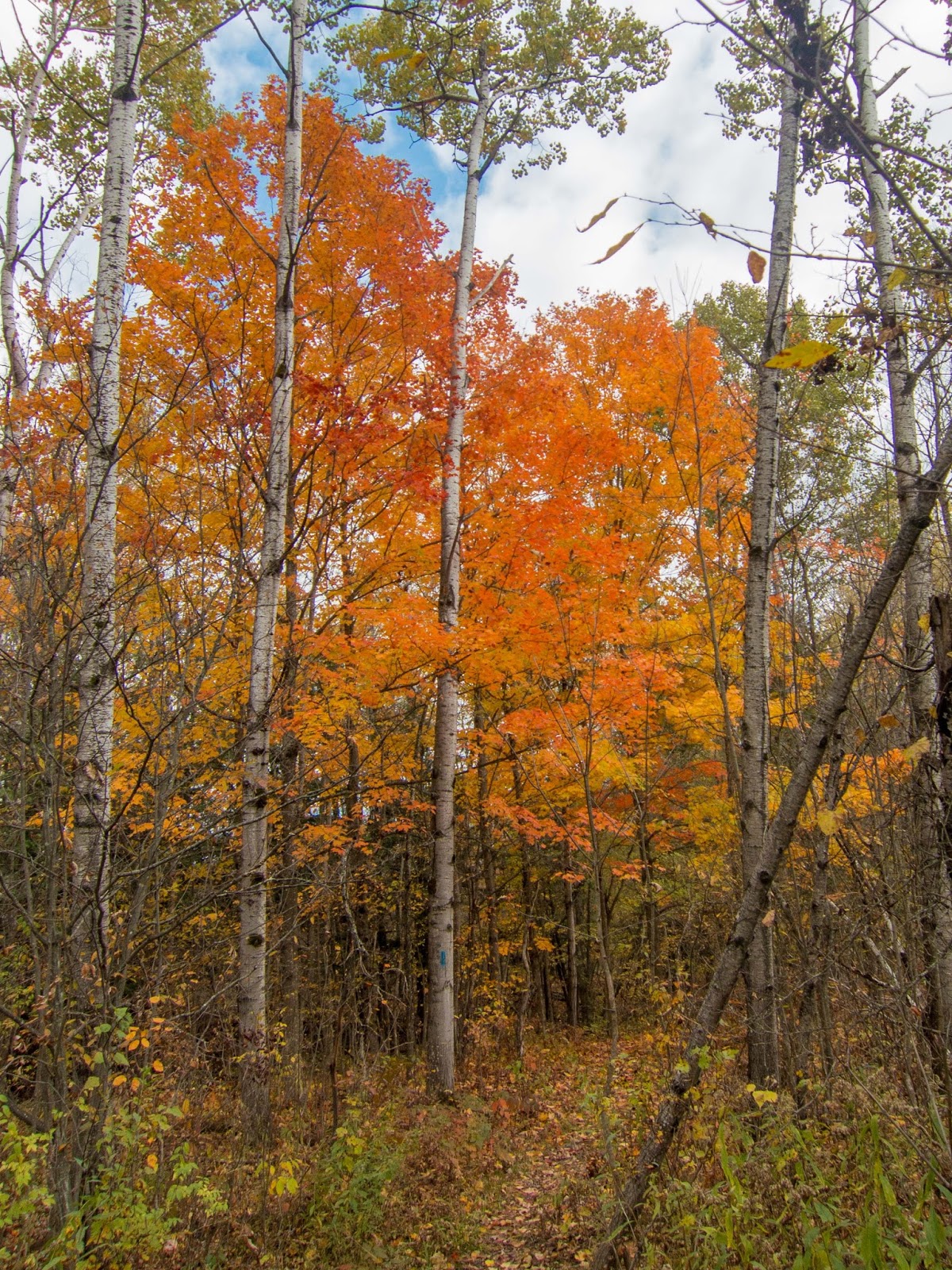
I continued on, my hike almost complete. There was an especially colorful tree.


Another potential campsite. I believe there is even a fire ring.


Soon I could see the train tracks through the trees. I knew I was near the Fife Lake Loop. I was surprised to find another campsite just a little south of the loop.

I made it to the Fife Lake Loop junction.

I took a break at the campsite on the peninsula between the creeks where I had stayed with my dad previously on the Fife Lake Loop.

Then I joined the Fife Lake Loop to Country Line Road where I had previously dropped off my bike. Another hike on the NCT was complete. This hike is arguably one of the best in the lower peninsula.

The return bike ride didn't work as well, and I ended up calling my dad who happened to be in the area. We got some pizza and then enjoyed the view from the other side of Hodenpyl Dam Pond at the roadside rest area.

Beautiful!
ReplyDeleteI ventured out with some hiking friends today and saw a great view of the Cadillac ski hill. We also found a geocache. I shared your great pictures with some friends. Nice job!
ReplyDeleteGreat trip report! For the section between the 12/15 roads TH and Highbanks Rollway, are the many established or social backcountry sites with relatively easy water access to either the Manistee or creeks/small streams?
ReplyDeleteThanks! It’s been a while, but I think there were opportunities for places to camp in that section. I remember passing a hunters camp. Much of that section is close to forest roads, I think my campsite near the river wasn’t anything official but was right by the road and river. Hopefully that helps a little.
Delete