Manistee National Forest
Distance: 60+ miles roundtrip
Highlights: Sterling Marsh, many lakes and creeks, Chuck's Prairie
Of all the national scenic trails, I have currently hiked the most miles on the North Country Trail, a 4600 mile trail from North Dakota to New York (soon Vermont). Whether it be beautiful segments in the Boundary Waters Canoe Area Wilderness (Border Route Trail, Kekekabic Trail), along Lake Superior's beautiful shoreline (Superior Hiking Trail, Pictured Rocks National Lakeshore), or in Michigan's Lower Peninsula (Manistee River, Jordan River Pathway), the NCT has provided exceptional backpacking opportunities.
This is the one of the finest sections of the NCT in the Manistee National Forest and lower Michigan.
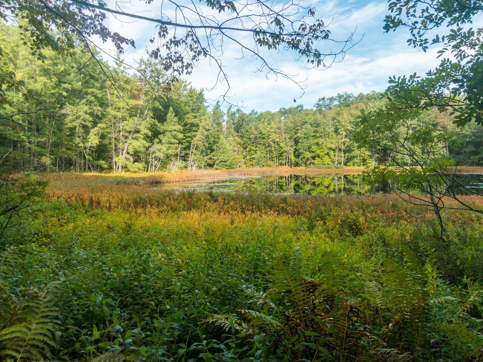
I began near the northern part of this section near Bowman Lake where the loop is near 56th St. A trailhead is also nearby, but I didn't use it.
I hiked a short distance to revisit Bowman Lake as I wanted to see it for a second time.
Bowman Lake

After passing the lake, I joined the NCT where I had left it the last time I was here.

I crossed 56th St.

After hiking through a few small hills, the trail turned east and was parallel to 56 St. Trail conditions were excellent.


I came to the junction for the spur trail to Bowman Bridge Campground, about a half mile away across 56th St. I continued on the NCT.


I continued until it was nearly dark. As the trail came close to the Pere Marquette River, I could hear people on the other side. I set up came above a pleasant stream that drained into the river. I ventured down to the river but didn't get a picture due to the darkness.

I awoke early with heavy rain after a rainy night and began hiking with the light of my headlamp. I passed a narrow section that had a fence on each side of the trail. As I reached Sterling Marsh, there was some light.
One of many bridges/boardwalks near Sterling Marsh.

Sterling Marsh


About half way through the boardwalk section there was a bench dedicating the boardwalk to Ed Chappel.


A nice bench at the end of the boardwalk.

The trail skirted the edge of some private property and then passed through a nice stand of pines.

I took a quick break to eat my first food for the day and enjoyed the view of a scenic pond.


Some fall colors were starting to come out.


Near 16 Mile Road came to the first trail register, which apparently had been vandalized. I could hear loud gunshots nearby.

There was a nice bridge across Cedar Creek.


I came to a nice pond near Highbanks Lake.

Looking down to Highbanks Lake through the trees

There is a spur trail the Highbanks Lake Campground, but I stayed on the NCT.
Highbanks Lake


Continuing on the NCT, the trail was marked by "Hiker Trail" signs.

I hiked off the trail a short distance for a view of what I thought to be Sawkaw Lake, but it was actually just a small pond. The lake is west of the pond.

Next I came to Condon Lake. The NCT stays up on the ridge (nice campsite), but I dropped down beside the lake and followed a path.
Condon Lake


I took a break at the scenic campsite on the southern end of Condon Lake.


As I neared Leaf Lake, there was a nice open area, maybe part of the lake previously.

Leaf Lake through the trees

Leaf Lake

It looked like there would be a great place to camp near here, near the southwest arm of the lake.

Atodd Lake


There was a great section of trail near Nichols Lake.


Nichols Lake


The NCT goes right along the shore of Nichols Lake.

It then comes out at the boat launch.

After the boat launch, there is a spur trail to the Nichols Lake Campground. I don't recall the junction being marked, but I turned south and continued to 11 Mile Road.

I next came to Tank Creek, where I met the first backpackers, I had seen on the NCT all summer.


The trail passed a few other scenic creeks, including Michigan and Bear Creeks.


After crossing Pierce Road, there was a chair for a break, if needed.

I met two other backpackers heading the other direction who asked about water availability and told me about an interesting open area ahead. I think it's called Chuck's Prairie.


I knew I would have to turn around soon after reaching the junction with the Birch Grove Loop.

I took a break at the nice meadow nearby to decide.

I probably didn't have time to make it back to a water source, so I decided to hike a short distance down the Birch Grove Trail to Loda Lake.

Loda Lake


After a restful time at Loda Lake and replenishing my water supply, I began my return journey. Soon I was back at Chuck's Prairie.


It was interesting to see the new growth from the stump.


The sun was getting low as I crossed Pierce Drive.


I actually made it back to the creeks I had crossed earlier.
Bear Creek


Near dark, a small road crossed the trail. I followed it to a clearing and set-up camp with the moon high above.


I awoke early the next morning and began hiking by headlamp. It was just starting to get light as I came to 11 Mile Road.

I enjoyed some exceptional morning views near Nichols Lake.

One of my favorite views yet on the NCT was at the Nichols Lake boat launch!
Panorama Sunrise at Nichols Lake


I left the NCT and followed an unmaintained trail that stayed closer to the lake.

After following the trail around Atodd Lake, I took the spur trail to the trailhead off Cleveland Drive. I hiked down to the boat launch for another view of Nichols Lake.

Nichols Lake


I wandered over to the nearby beach and enjoyed a great morning view.


Back on the NCT, I passed Leaf Lake.
Leaf Lake


Then I was back at Condon Lake.

There was a great reflection.

Condon Lake

Then the pond by Sawkaw Lake.
Highbanks Lake

Sign near Highbanks Lake


Cedar Creek


Back near Sterling Marsh


Sterling Marsh


I came to the place where I previously hiked in the dark. The trail was right between two fences.

The creek near my first campsite.


I found what would be a nice campsite near the Pere Marquette River.


Soon I was back at Bowman Lake.

Bowman Lake

I hiked the short distance back to my vehicle and another hike on the NCT was complete. This was certainly one of my favorite sections of the NCT in Lower Michigan.
I am wanting to hike the NCT/Bowman Lake Loop over the weekend. Do you know where I can get map/information?
ReplyDeletehttp://www.getoffthecouch.info/lake/bowmanlake.htm
ReplyDeleteAlso the NCT interactive map https://northcountrytrail.org/trail/maps/
The book Backpacking Michigan also has a description I believe. Have a fun time!
That vandalism at the trail register was the work of the "wily" porcupine. i had one near me eating the wood register for two solid nights at the Jordan Valley Pathway campground. The Rangers had set up a trap for him with dog food but he was only interested in eating the wood from the registration booth all night long.
ReplyDelete