~55+ miles roundtrip
Of all the national scenic trails, I have currently hiked the most miles on the North Country Trail, a 4600 mile trail from North Dakota to New York (soon Vermont). Whether it be beautiful segments in the Boundary Waters Canoe Area Wilderness (Border Route Trail, Kekekabic Trail), along Lake Superior's beautiful shoreline (Superior Hiking Trail, Pictured Rocks National Lakeshore), or in Michigan's Lower Peninsula (Manistee River, Jordan River Pathway), the NCT has provided exceptional backpacking opportunities.
I will have time to hike a significant portion of trail this summer and coming fall in Michigan's northern Lower Peninsula. Section hiking the NCT's established trail in the Lower Peninsula is becoming a realistic goal. This hike connects Petoskey State Park to South of Chandler Hills at Thumb Lake Road.
For a map of the route see below.
I began at a point midway between the ends of the route at the Trailhead on Krause Road. This was due to limited camping on the northern section and I was too cheap to spend $30+ to camp at Petoskey State Park.

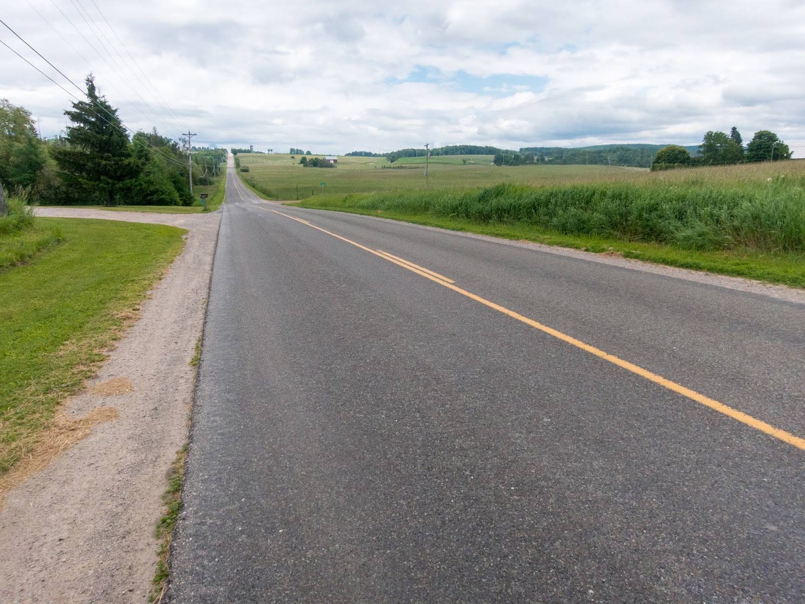
I began hiking southbound under some power lines.

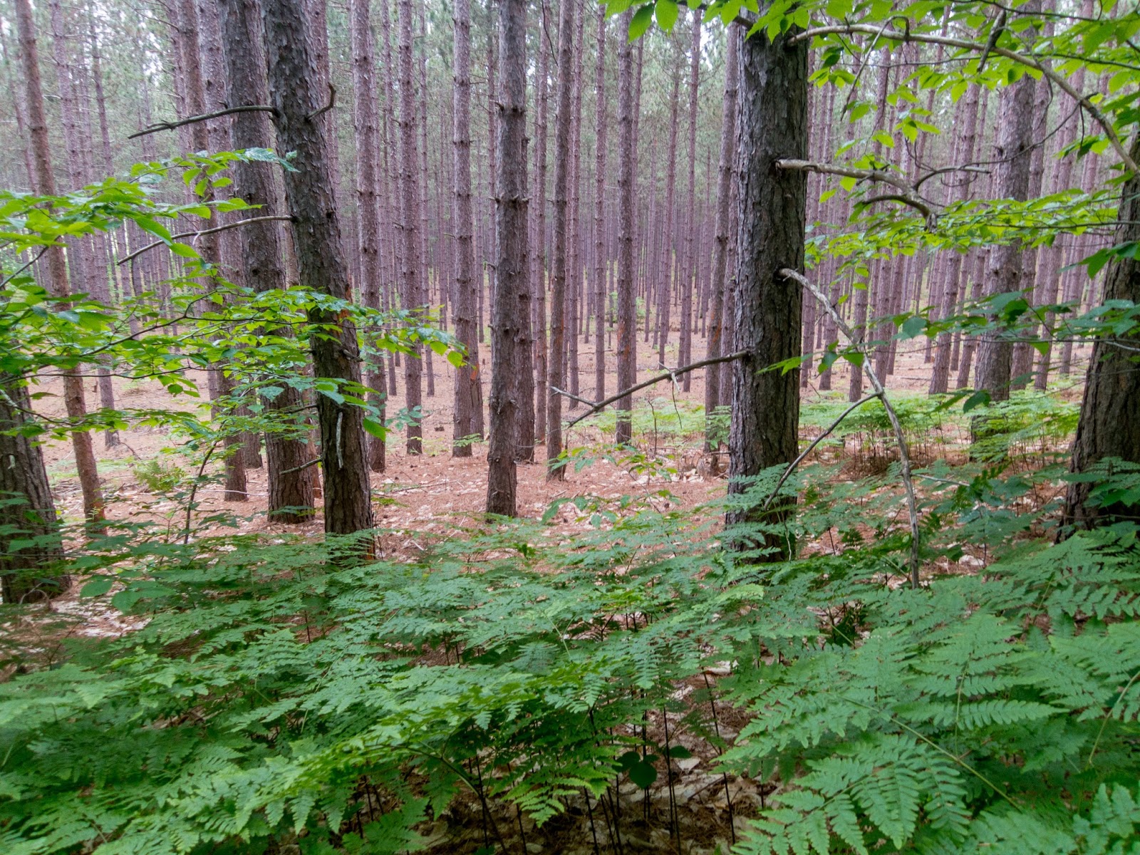
Then I entered the forest for a beautiful section of trail.

In some places it was quite sandy.

I came to a nice clearing in the evening.

Then a nice section of forest.


Next was some classic NCT farming country on a roadwalk.

The sun was setting over the hills I had previously traversed.


Soon after some small dogs followed me down the road, I was back on established trail with well-constructed boardwalk.

The evening light lit up the trees.


After crossing Welsh Road, the trail brought me to this view of the sunset.


The trail was right beside the edge of the field.


I made my way to the Cherry Valley Overlook on a spur trail.

It was a great evening view!

I could see the towers in the distance from where I believe I started my hike.

The moon was a small sliver high in the sky.

I set up camp nearby in the woods. In the morning I enjoyed the view again.

Sunrise through the trees from where I set up camp.


I continued on the spur trail back to the NCT and continued scenic forest hiking.


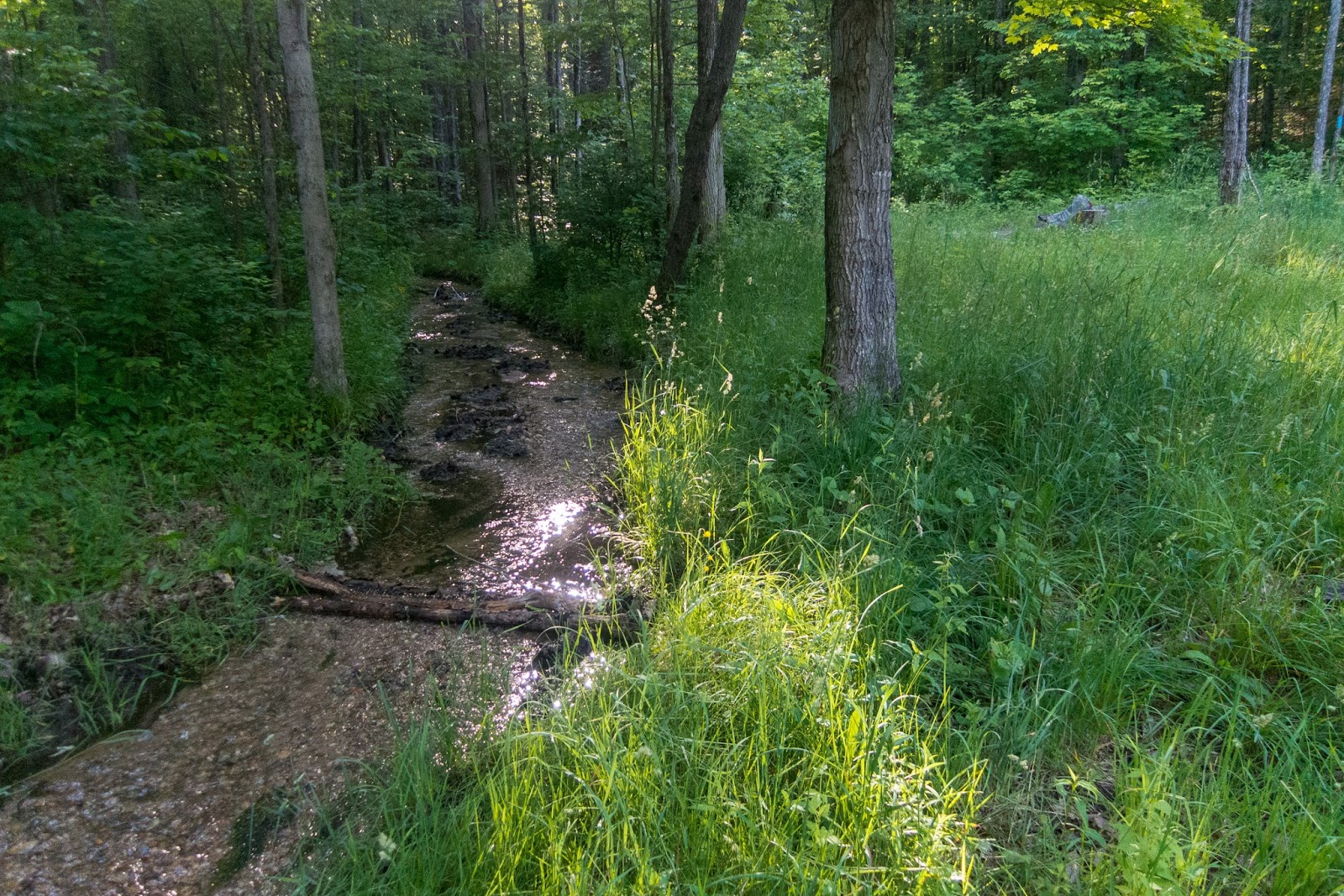
I took a break near this stream and re-filled my water supply.

Soon I reached Thumb Lake Road and decided to turned around instead of starting the roadwalk to the parking area. On the way back I enjoyed the same from a different perspective.


In one spot a couple trucks drove past me. Otherwise I wouldn't have known I was hiking a roadwalk. I also saw two guys out digging up large rocks.


Back at the junction to Cherry Valley Overlook.


I decided to hike back on Welsh Road for different views.


Then I returned to the main roadwalk past this interesting building.

Then I was back on established trail to the parking area.


Back at the trailhead I took a short break. There were several bikers getting ready to head out on the trail. I only had a short distance to the established campsite nearby, so I took my time.

I signed the trail register nearby and began hiking on the Skyline Trail.


Near the campsite there was a nice bench constructed in the forest.


The view from the campsite.

I hiked over to the view from the observation deck.


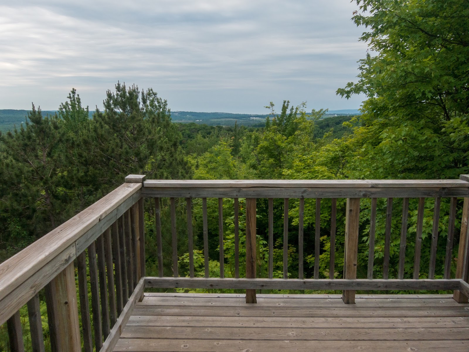
It took me a little while to realize I was actually seeing all the way to Lake Michigan.


My tent at the campsite.

There was also a platform nearby and other equipment.

The view the next morning from the look at tower was in the clouds.

Back in the forest, the trail descended and then had a switch back filled climb.


Next was a road-walk.

The expansive views of the farmland was in the fog.


Part of the roadwalk was on an empty dirt road.


The clouds began to clear as I neared the end of the roadwalk.


I made it back to real trail and entered the North Central Michigan College Natural Area.

There were nice sections of boardwalk.


Small waterfalls off tree roots.

The Bear River

A pond by North Central Michigan College

I walked through the parking lot and then made my way to a bridge over the Bear River.

I found a sign detailing how Petoskey is an official NCT trail town.

I followed the trail along the Bear River.

There were many flowers near they edge of the trail.

I crossed over some railroad tracks.


Bear River


I climbed to the top of an observation tower for a view of the river below.

I left trail and hiked into Petoskey looking for some food, knowing I would return to the trail on the way back. I rejoined the trail near the marina.

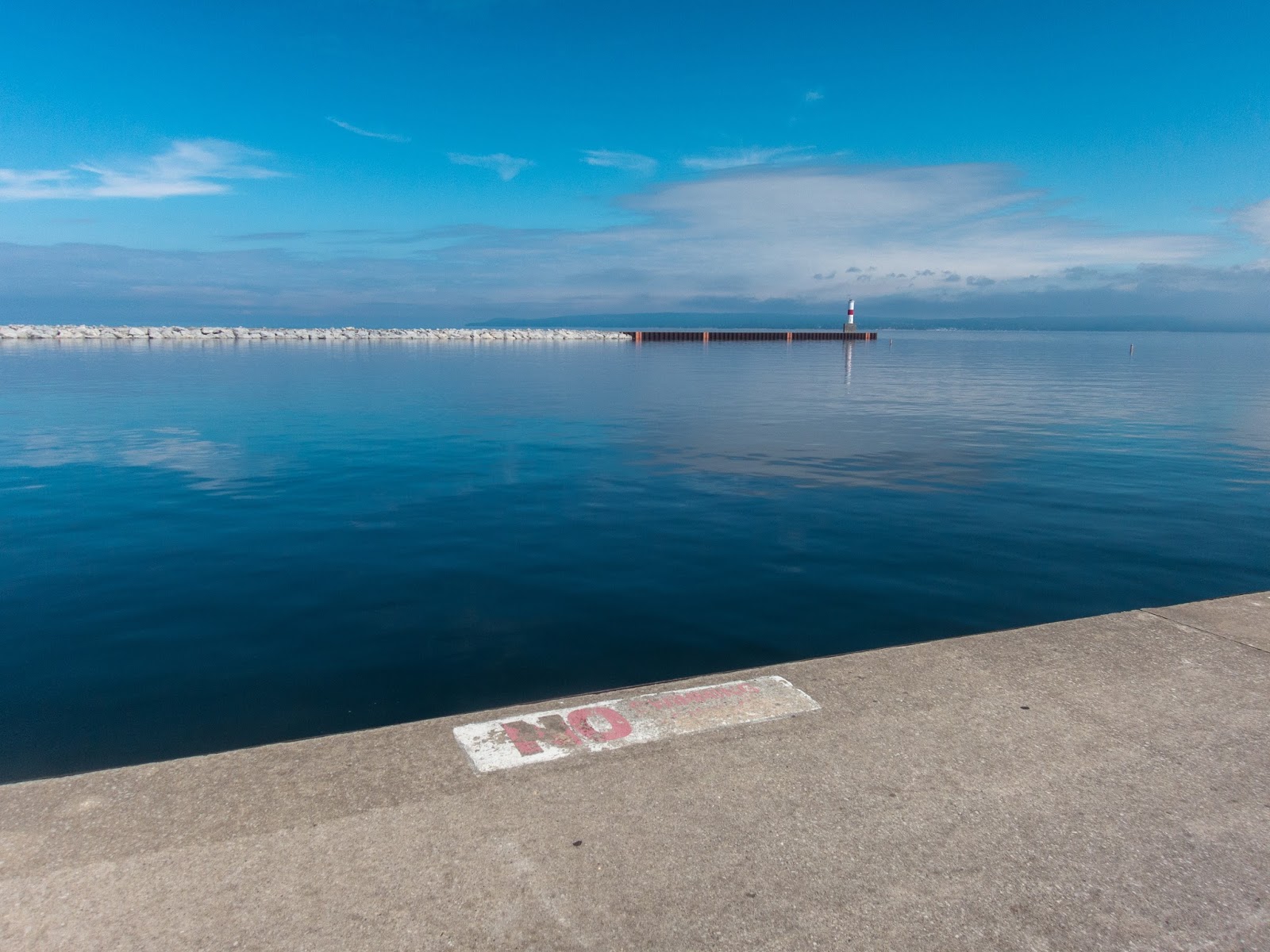
I walked out on the dock for a view of Little Traverse Bay.


I returned to the NCT and continued on the Little Traverse Wheelway.


Soon I reached Petoskey State Park and after walking through the campground, I made my way to the beach.


I began my journey back on the Little Traverse Wheelway. There was interesting artwork showing the history of the wheelway over time.

Part of the Wheelway is a large sidewalk.


The Petoskey city limit sign also has an NCT trail town sign.


There was a nice waterfall along the Wheelway.

Soon I was back at the Bear River.

The Bear River was quite dramatic as it neared Lake Michigan.


There continued to be many flowers along the trail.

The Bear River is popular with kayakers.


Crossing the train tracks for a second time.


Back into the North Central Michigan College Natural Area.


Back to pleasant farmland.

This time with impressive views all the way back to the hills where the trailhead is located.

Back on the road walk.


Some cows stared at me as I walked passed.

I returned to the woods.

I met a family out hiking to the Skyline Overlook.

This time the view made it easier to see Lake Michigan.


In a short distance, I was back at the trailhead. It was a great weekend filled with lots of variety on the NCT: scenic forests, road walks, viewpoints, the Bear River, Petoskey, and Lake Michigan.
You'll have to stop back to see the new shelter at the skyline trail now that it's finished! Dove and John Day, JV45 Trail Coordinators
ReplyDeleteEric, your blog is great! I love all the pictures. It's nice to see your take on our section near Petoskey, and on so many others. Next time you're up near Petoskey, give us a call. Dove and John Day, NCT JV45 Trail Coordinators 231-373-0090 or 231-838-6445
ReplyDeleteThanks for checking out the blog. Hope you had fun on the rest of the Fife Lake Loop. We enjoyed the rain...lots of it! Thanks for all you do to support the trail!
Delete