July 26-27, 2014
I entered the Grand Teton National Park after a short visit to Yellowstone National Park (see here) as part of a road-trip back to Michigan after completion of my last clinical of physical therapy school. This post is primarily about one of the finest day-hikes in the US, the Paintbrush/Cascade Canyon Loop, but I will also include photos at the bottom from elsewhere inside Grand Teton National Park.
This ~19 mile loop includes some of the most stunning mountain scenery in the lower 48 including the Tetons, lakes, and streams. I hiked this loop counter clockwise as is typically recommended.

image from http://www.greater-yellowstone.com/graphics/maps/solitude-map.jpg
I awoke early in the morning and packed up my camp in the Lizard Creek Campground. I had stunning morning views of the Tetons on my way to the String Lake Trailhead.

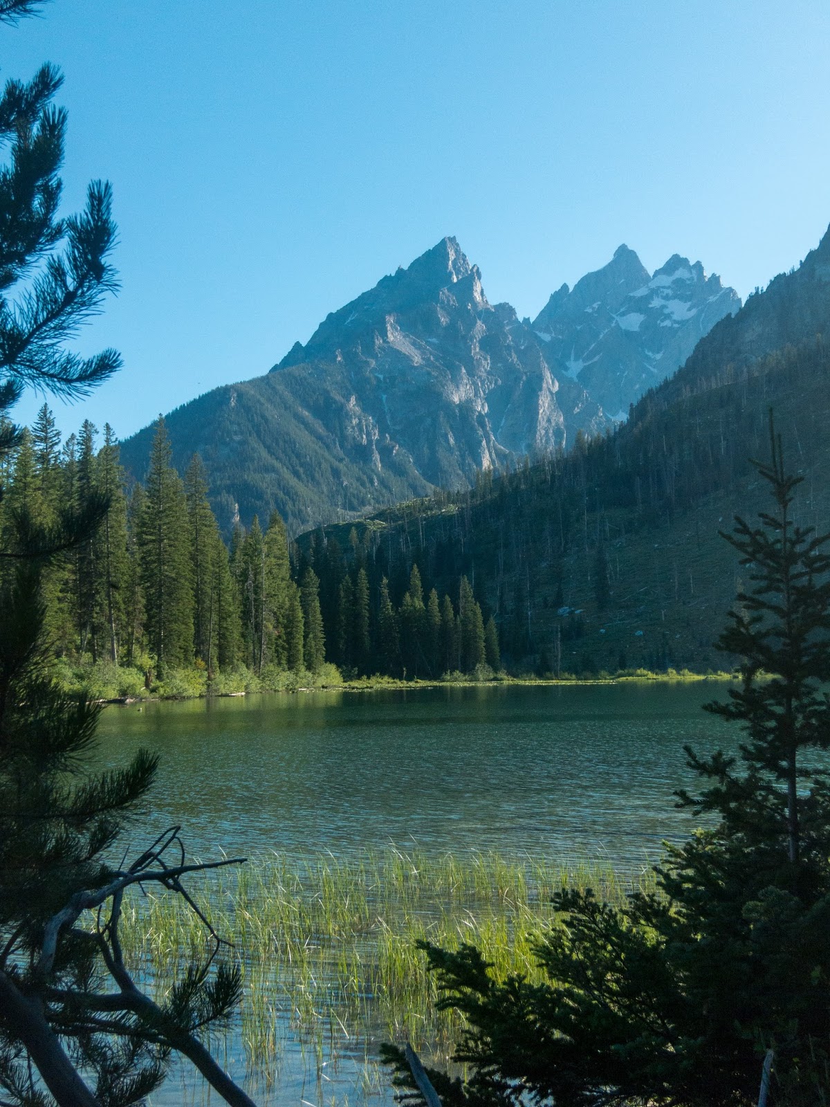
I quickly got my day pack ready and soon I was on the trail and crossed the bridge between Jenny and String Lakes.

I turned North and hiked mainly through the forest beside String Lake. I left the String Lake Loop and made my way up into Paintbrush Canyon.

As I climbed the view behind me became quite scenic.

There were many nice flowers along the side of the trail.

The trail followed a pleasant stream as it ascended.


The view looking back kept getting better.

It was quite a climb and I began to break out of the trees.


There was still a significant amount of snow at the higher elevations visible.

I took an alternate and worthy route to Holly Lake with Mount Woodring dominating the background. There were quite a few mosquitoes in the area, so I didn't stay long.

As the trail continued to climb, I began to hike through snow.


These type of views are hard to beat!

As I neared the top, I heard another hiker call down to me asking if he was still on the trail. He had missed a switchback and climbed up too far. We continued together.


The view from Paintbrush Divide was great!

I continued on the trail and passed some backpackers going the other way. Turns out they didn't have trekking poles, ice ax, or crampons. The other hiker I had been hiking with rented some and volunteered to let them use his if they would return them for him.


Watching them traverse going down was actually much scarier than when I went across myself. It was a relief to see them make it to the other side safely.


I began the descent to Lake Solitude with spectacular views.

Lake Solitude on the left

There were great views down Cascade Canyon!

And a beautiful display of flowers.


Panoramic view all the way up Cascade Canyon to Lake Solitude

I made my way down to Lake Solitude and took a short break. There were several others hikers in the area.

I met a nice man who discussed long distance trail running with me. Turns out he actually completed the Leadville 100 which shares the route of part of the Colorado Trail including the portion over Hope Pass.

I continued my descend through Cascade Canyon.


The views were constant.


I came to the trail junction for the Cascade Creek Trail. There was a great view of Mount Owen, I believe.


Eventually I made it to Inspiration Point and a great view of Jenny Lake.

Many trails were closed in the area, but I found a way over to Hidden Falls.

I continued along the shore of Jenny Lake on my way back to the String Lake Trailhead.


Soon I was back a the bridge where this fantastic loop hike started.

After completing this day-hike I understand why it is regarded as one of the best. The scenery is nearly unbeatable. There is also an opportunity to backpack this route as there are designated campsites along the trail. It's hard for me to think of a better day-hike that I've done at this point, while there are certainly portions of backpacking adventures that compare (JMT, Wonderland, CT, etc). The closest personal comparisons as far as scenery as day-hikes are Half Dome (when I was quite young) and Angel's Landing.
Here are some photos from elsewhere in Grand Teton National Park.
The Tetons from Jackson Lake

Snake River Valley from Signal Mountain.

Tetons from Signal Mountain


Snake River from Signal Mountain

Jenny Lake Trail

The Ansel Adams classic photo spot

Buffalo

A nice evening view from Oxbow Bend

Jackson Lake and the Tetons


A great evening view!

I wish I had had more time to explore the Yellowstone/Teton area, but it was necessary for me to return to Michigan to graduate from school. I plan to return for extended backpacking trips in the future including something similar to Skurka's Yellowstone Circumnavigation and also the Teton High Route.
Hi Eric - what kind of camera do you use while hiking?
ReplyDeleteMatt, I've been using a Canon S100 since I began the Colorado Trail in 2013. Got a great Black Friday deal! Before that I was using a smaller Canon point and shoot. Thanks for reading.
DeleteI am hiking this same trail in July (paintbrush canyon loop). I'm terrified of heights and dislike exposed ridges. Do you think I will have much of a problem?
ReplyDeleteAs you can see there was still quite a bit of snow when I went over the divide. There was a track through the snow but a slip could have been catastrophic. I was fine with my trekking poles but watching others descending was scary as they had full backpacks and didn't seem as prepared to travel on the snow.
ReplyDeleteDefinitely check for updates on trail conditions before heading out. You may need experience with an ice axe or traction devices: micro spikes or crampons.
It's a beautiful hike, probably one of my favorite day hikes that I've done!