July 10-12, 2015
~63 miles
Of all the national scenic trails, I have currently hiked the most miles on the North Country Trail, a 4600 mile trail from North Dakota to New York (soon Vermont). Whether it be beautiful segments in the Boundary Waters Canoe Area Wilderness (Border Route Trail, Kekekabic Trail), along Lake Superior's beautiful shoreline (Superior Hiking Trail, Pictured Rocks National Lakeshore), or in Michigan's Lower Peninsula (Manistee River, Jordan River Pathway), the NCT has provided exceptional backpacking opportunities.
I will have time to hike a significant portion of trail this summer and coming fall in Michigan's northern Lower Peninsula. Section hiking the NCT's established trail in the Lower Peninsula is becoming a realistic goal. This hike includes great scenery just south of the crowds on the Manistee River Trail/NCT loop. Highlights include the hills above the Manistee River Valley, beside the Manistee River, Udell Hills, the Little Manistee River, and much more. The distance between Upper River Road Trailhead and Freesoil Trailhead is the longest weekend mileage to date.
I began the hike a short distance from the Red Bridge Manistee River access at the Upper River Road Trailhead on Friday evening. For a map of the route see below.


The spur trail climbed up steeply in places.

I came to glimpses of distant views of the Manistee River valley through the trees.

After reaching the NCT junction, I turned left and headed south away from the Manistee River Loop.


I crossed Coates Highway and returned to the forest.

The trail was in good shape.

I came to a couple of views less obscured by the trees.


These views would be especially scenic in the fall I imagine.


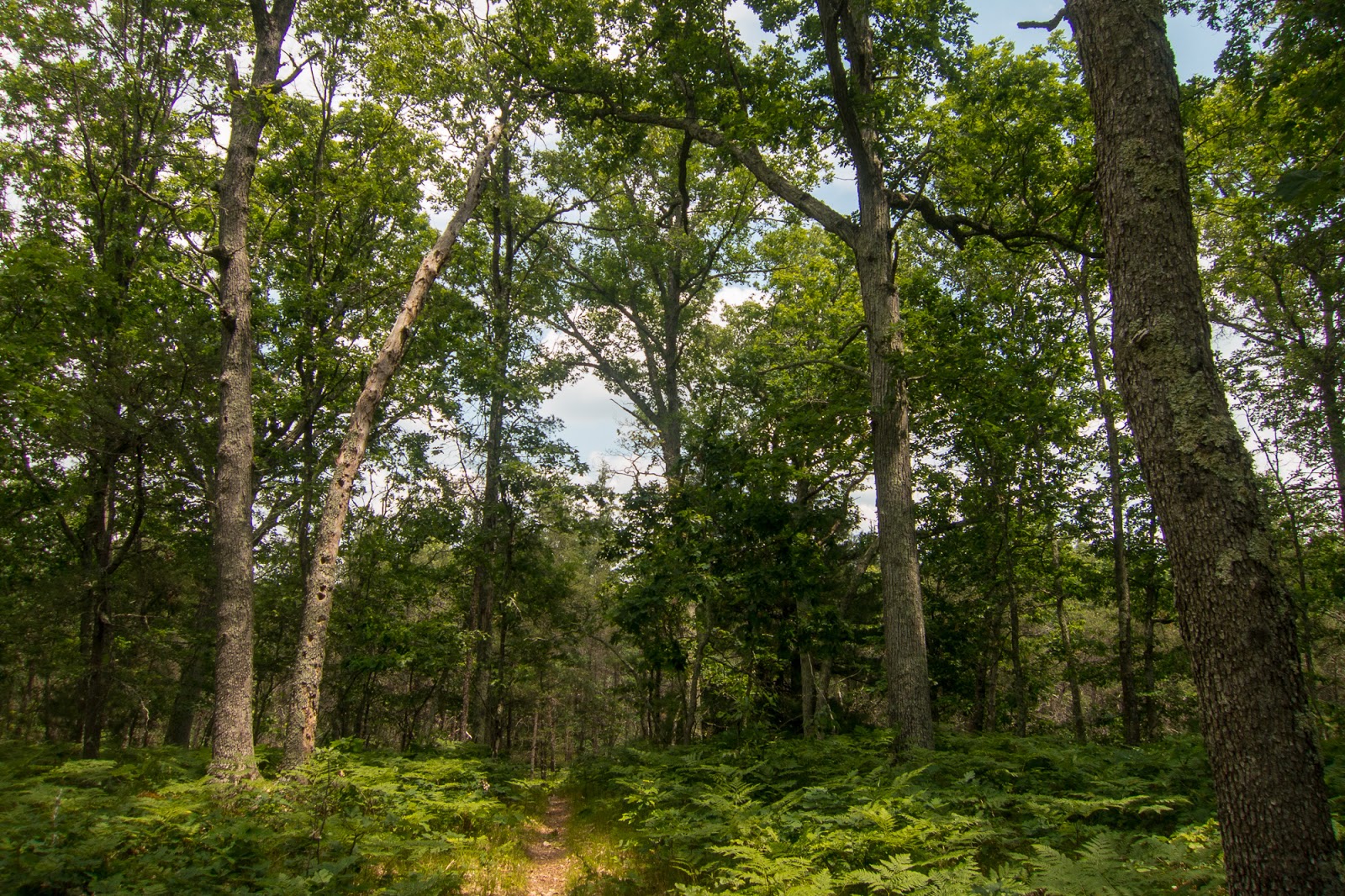
The trail continued to provide excellent forest hiking.

I traveled around some rolling forested hills. There were even a few markers that seemed to indicate distance but not quite sure.

Part of the trail travels across Tribal property of the Manistee Reservation of the Little River Band of Ottawa Indians. There were signs indicating that camping was not allowed in this area.


The trail through a nice section of hardwood forest.

The trail crossed Dilling Road.

I came to a junction indicating the trail to Sawdust Hole National Forest Campground. There's really not that much incentive to camp in the National Forest Campgrounds along the NCT as dispersed camping is typically allowed away from the trail and water sources.


I continued on the NCT with a glimpse of the Manistee River down below.


I made my way to a clearing near the Manistee River.

I sign indicated interesting history at the Sawdust Pile bayou.

It was a beautiful evening.


I could see the trees rising on the other side of the Manistee River.


There was a fairly large group of I believe boy scouts camped nearby along the river.

I heard a sound overhead and looked up to see a bald eagle flying out over the Manistee River. It's present in the picture below, but hard to see.

There were some great evening views of the Manistee River.


As the trail went inland briefly there were some nice flowers.


Back at the edge of the Manistee River there was a great evening light.


I was tempted to find a place to camp, but decided to continue on.


The trail turned inland and crossed a scenic bridge.

Then it climbed up some impressive switchbacks.

After following the ridge for a little while, I decided to look for a campsite near the river. There was quite a bit of undergrowth and not much for campsite selection, but I did get another view of the Manistee River.

I climbed back up the hill and found a nice campsite in the forest. Early the next morning the sun shown through the trees.

I was on the trail and hiking by 7am and it was probably the longest day I have ever hiked at I think over 35 miles. The NCT traveled along forested ridges.


There was some expansive views.


In one stretch the trail was re-routed due to trail erosion. The detour provided a great view of the Manistee River below.


I came out to North Highbridge Road and followed it toward the Manistee River.

I crossed over the Manistee River with great views.

On the other side I took a short break under the bridge to eat a snack.


Back on the NCT, I continued through interesting scenery. There appeared to be an interpretive trail with numbered sign posts along this section, but I didn't have the brochure discussing the features.


There was a great section through a red pine plantation.


I reached the Blacksmith Bayou National Forest Campground but continued on the NCT.

The trail went to the roads for over three miles. I had a couple encounters with dogs. One greated me pleasantly and started to follow me on the road. The other barked at me aggressively, but did not enter the road. Along the road walk I discovered a great campsite provided by a private landowner. I took a short break and signed the trail log.

The campsite was equipped with an outhouse, picnic table, fire ring, and even gallons of water. Thank you to this generous landowner!

Near the end of the roadwalk I crossed Pine Creek.


It was good to be back on trail.

Soon I crossed Caberfae Highway and reached the Udell Trailhead.

There was kiosk with information about the North Country Trail and also a water pump nearby. I met a couple of mountain bikers here out enjoying the beautiful day.


The NCT went through the "Big M' cross country ski and mountain bike trail system. I looked for a potential alternate on my way back but didn't see anything that didn't require a fairly significant detour. The NCT is the purple trail on the map below.

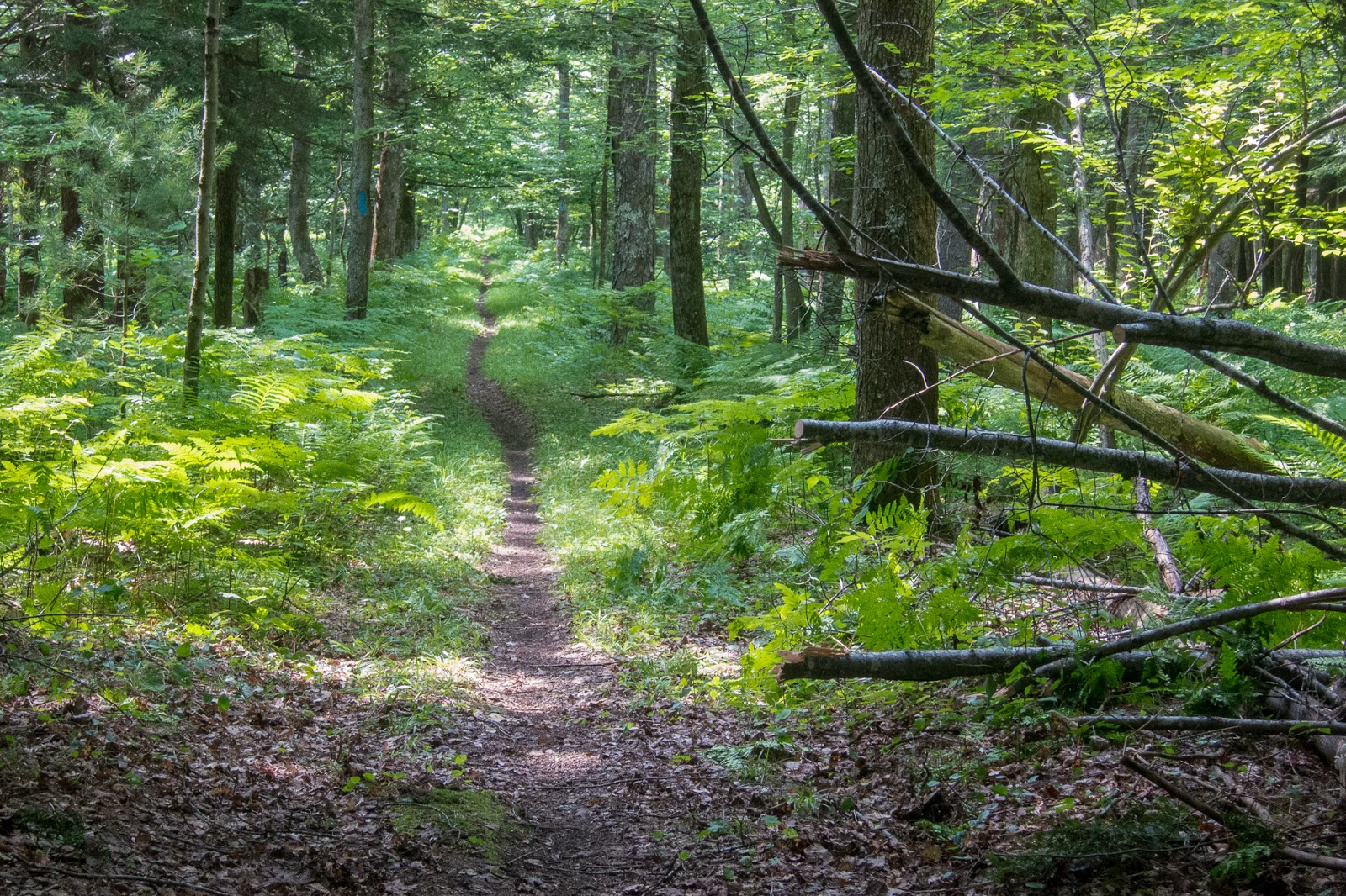
There was more great forest hiking.


I reached Madison Road and made my way to Nine Mile Bridge over the Little Manistee River.

The Little Manistee River

Initially I had considered turning around at this point and starting my hike back, but it was still early in the day. I decided to continue to Freesoil Trailhead. There was a short road walk after crossing the river. I met a nice guy driving a van who was familiar with the NCT. He asked if I had hiked the upcoming section before. When I told him I hadn't, he told me that really liked it.

Returning to the official NCT

This certainly was a great stretch of single track. There were several groups of mountain bikers who passed me during this section.


There was a beautifully constructed boardwalk.


I came to the junction to the Bear Track National Forest Camground.


The trail traveled along a swampy area near Freesoil Trailhead. There were a few bugs in the air.

I took an extend break at Freesoil Trailhead.

Back on the trail I decided I would continue hiking until 9 pm and see how far I could get.

The section near the swamp

Back near the trail junction to Bear Track Campground, I took a picture of an interesting flower.

At the boardwalk there was a sign indicating that the boardwalk was dedicated to Chips, the "hiker pup" and all our four-footed hiking companions.


Soon I was back at the short road-walk to the Little Manistee River.

I re-entered Manistee County.

9 Mile Bridge

Little Manistee River


A trail connector marker on the back of a sign

Someone had unfortunately disrespected the NCT emblem.

I noted a skull by the trail that I hadn't seen before.


Soon it was evening and I looked for a place to camp in the Udell Hills. It had been quite the day.

Even though I was quite tired, I had trouble sleeping. I decided to keep on hiking at 3:45 am and packed up in the dark. It had been quite some time since I had done a hike in the dark.

I took a break at the Udell Trailhead to get some water from the pump and stared up to the star filled sky from the parking lot.

After completing the road-walk for the second time, I enjoyed the sunrise through the trees in the red pine plantation.


There were also great morning views from the bridge across the Manistee River.


Sunrise from the Manistee River.

Island in the Manistee River

As I enjoyed some food, I noticed that the sun was reflected in the river.


This was a great experience, one that wouldn't have happened if woke up at a normal time.

I continued around the detour section.


Back to the great view over the Manistee River below.

Here is a sign indicating the section of trail is closed.


There were even some steps constructed into the ridge.

I passed my first campsite and then descended to the bridge.

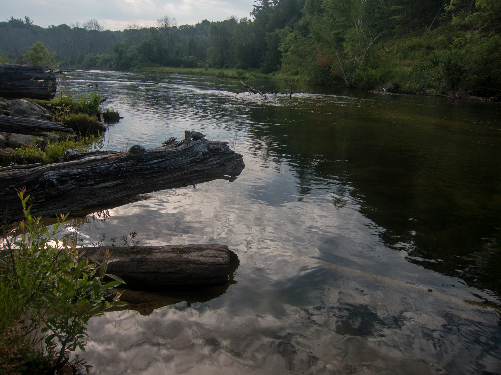
I was back in the scenery near the edge of the Manistee River.

Manistee River

Much of the NCT is on a small bluff, making access to the river challenging.

I found a place where I could sit on a log by the water and enjoy a snack.


This section beside the Manistee River almost as scenic as the Manistee River Trail, but without the crowds.


I saw the scout group beginning their hike out.

I found an interesting waterfall in a small stream.


I decided to leave the NCT at Dilling Road and hike to Tippy Dam for an alternate on the way back.


Some of the hiking was on the road, but I also found trails in the forest nearby. I even found an overlook of the Manistee River.

Tippy Dam

There were several people fishing near the dam.

The top of the dam. I don't believe access was permitted all the way across it.

Tippy Dam Pond

I took a break at a scenic picnic area nearby and enjoyed the view.

I decided to continue my hike back on Upper River Road.

The road was flat with little elevation change, but was also sandy with little shade.

There were several campgrounds along the road, but I didn't venture far enough to get a great view.


Soon I was back at Coates Highway and could see the finish of the hike.

I made it back to where I started at the Upper River Road Trailhead. I was quite tired and it hadn't even been two full days since I left.


Overall, this was a great weekend hike with great trail throughout. The Manistee National Forest has some of the finest NCT in Lower Michigan. This section has many highlights similar to the MRT/NCT loop, but is no where near as crowded.
Thanks for sharing your hike, Eric. I'm planning my first multi-day hike along the same trail later this summer, and your information and photos are inspiring!
ReplyDeleteDid you stop at the fire tower?
ReplyDeleteI would have but wasn't sure where it was!
Delete