The Wild Rogue Loop is an awesome loop route in Southern Oregon. It includes the stunning view from Hanging Rock and also one of the finest sections along the Rogue River Trail. In total the loop is about 30 miles (my phone said 31.9) and has lots of elevation gain (my phone said over 5000 feet). I completed this as a trail run in a single day. I arrived the day before and camped at Panther Camp near Hanging Rock and then ran the loop clockwise the next day.
Helpful resources that I found were from Hiking Project which includes a gpx file and OregonHikers Wild Rogue Loop Field Guide which includes mile by mile data and water sources. This is also one of the signature routes of the Siskiyou Mountain Club.

This was kind of a spontaneous adventure for me. It was supposed to be a rainy weekend, but when I checked Saturday afternoon it looked like only a slight chance of rain and relatively cool temps for June so I decided it would be a perfect time to complete the loop.
I enjoyed the drive to the trailhead at the end of FR230 up on the ridge. The trailhead didn't have much more than the end of the road and this sign.

I quickly was on the trail and there were nice flowers.


The mileage data list I found online said it was less than a mile to Panther Creek Camp(different than the Panther camp on the map) were there was a stream that was expected to go dry in the spring. It had rained some the last week so I hoped it would have water. Otherwise I would need to go back to my car.

The trail climbed up and it felt like I had gone farther than a mile.

I could see a view over the trees.

I reached Panther Camp and there was water in the stream and a great place to camp. I set up my tent.

Panther Camp is about a mile from Hanging Rock so I decided to go cook some food and enjoy the view.

The trail climbed up some more and then I reached a junction with a spur to Hanging Rock.


Approaching Hanging Rock

There is a great view of the Rogue River Canyon 3000 feet down below.

Hanging Rock


I was the only person there and took some time to make some tacos and read.

Panorama of Hanging Rock


I headed back to camp and hoped to get some rest for the big run the next day. It would be my longest run that I had down. I anticipated it would be in the high twenty mile distance and also my first marathon. It took some thinking to decide which way to do the loop. I read that the climb up the Clay Hill Trail was quite steep and for hiking it was recommended to go counterclockwise, but there were also creek crossings on Mule Creek that might be impassible that would be closer if I went clockwise. I also thought a more gradual descent would be better for running. I eventually decided to go clockwise.

I packed up my tent and had my running vest fully packed with over 2000 calories and all the essentials. I hid my backpack behind a stump and began the run around 7 am.

It was a pleasantly cool morning

I quickly returned to the trailhead and passed my car and joined the trail toward Mule Creek. In some places the trail followed an old road.

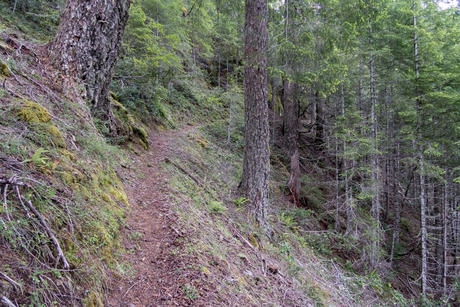
There was nice trail through the forest and a fairly gentle descent.

I entered the Wild Rogue Wilderness.


I could see a prominent rock up above and wondered if it was Hanging Rock.


I passed several tents near the West Fork of Mule Creek.

I stopped to refill my water bottle at one of the creek crossings and almost lost it but was able to find it in the water. This was fortunate as it was really needed for the dry section climbing up the Clay Hill Trail.


There was an awesome section of trail by Mule Creek.


There was a bridge where two creeks combined.


There was an impressive sign at the beginning of the Mule Creek Trail at the Tucker Flat Campground.

I went through the Tucker Flat Campground and then enjoyed an easy section on the road to the Rogue River Trail.


I went past Marial Lodge.

There was an old fire station.

A couple cars were parked at the trailhead.


I entered the Wild Rogue Wilderness again.

Mule Creek Canyon

Rogue River


The section of the Rogue River Trail on the Wild Rogue Loop is one of the best.

There was a nice waterfall on a creek on the other side of the river.


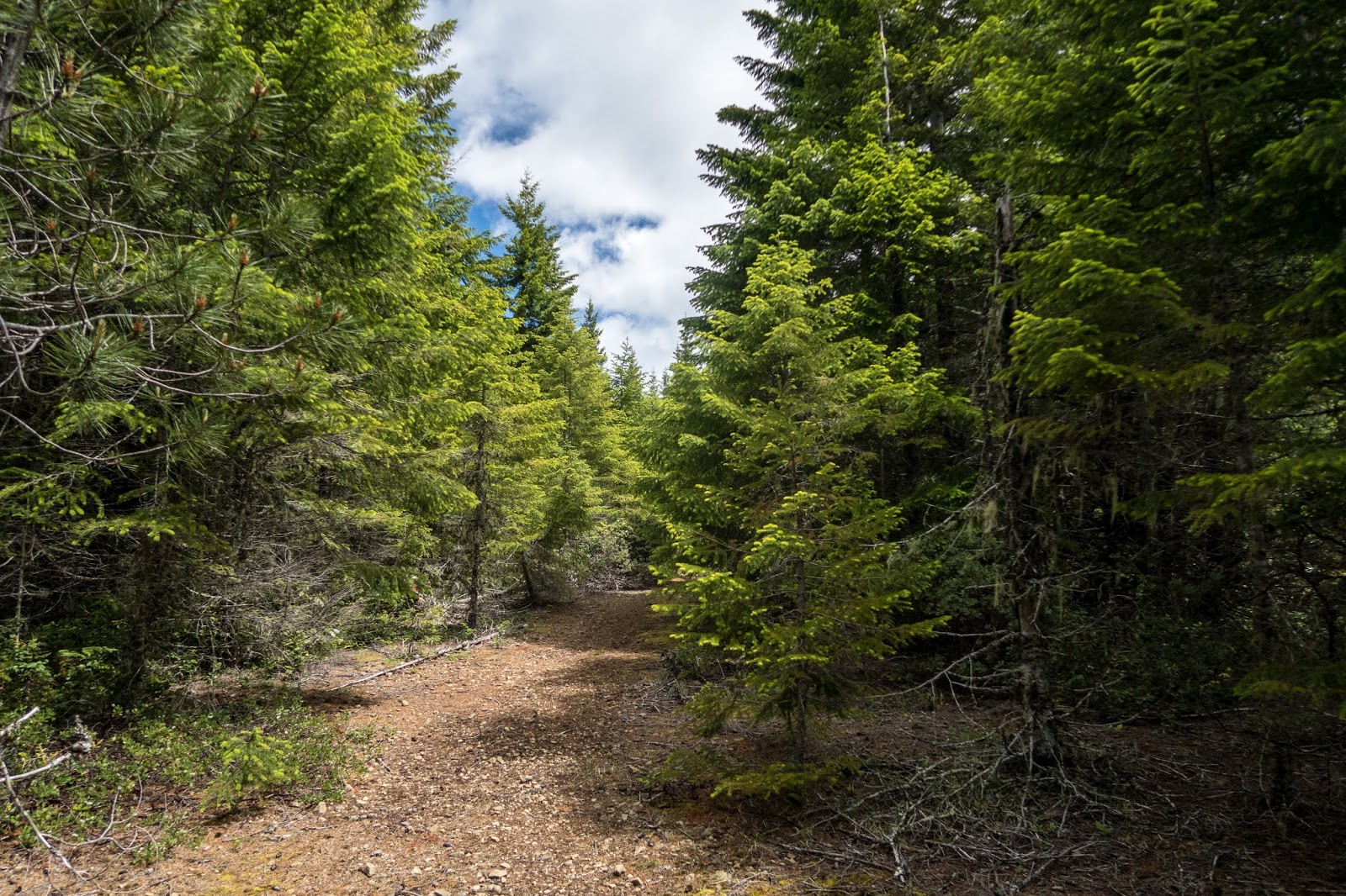
The trail went in the forest.


I passed a few groups of backpackers and a couple trail runners. There were camps of rafter groups on the bars beside the river.


I passed the Brushy Bar Campground where I had camped previously.

I began keeping my eye out for the Clay Hill Trail.

I found it just before Clay Hill Creek. I went down to the creek to get some water. This was the last water until I was all the way back to Panther Camp.

It's a steep climb back up to Panther Ridge (~3000 feet) and I decided to hike it at a steady speed which turned out to be around 17-20 min/mile.

There was a nice view of the Rogue River down below.


Most of the climb was in the forest providing shade and there was also a cool breeze.

I was excited to reach a sign at a junction on top of the ridge.


Up on the ridge it was much easier and even though I was tired I was still able to run most of it.
There was a nice open view.


My phone had already told me I had gone 30 miles by the time I reached the Hanging Rock Junction.


There were quite a few people enjoying the scenery at Hanging Rock.

I went to the top and didn't stay for long.

I continued down to Panther Creek Camp and finished the run, unexpectedly my first 50k in a little over 6 hours.

This was an awesome loop. I really enjoyed the different type of scenery when combining the views at Hanging Rock and being beside the Rogue River. I had great weather. There weren't many people except on the Rogue River Trail and at Hanging Rock. I did manage to get stung on my leg and also had one tick. I didn't see any rattlesnakes. For such a long run for me, I think it helped that I stayed ahead of my nutrition and hydration and made an effort to keep eating and stopping to refill water. Overall, the trails were in good shape. Up on the ridge, I had to push through some vegetation that is trying to grow over the trail but nothing significant that really slowed my progress.