The North Cascades are often called the "American Alps." North Cascades National Park offers some of the most remote and rugged hiking and climbing in the Lower 48. The main roads through the park stick to the valleys. Getting into some of ninety-plus percent of the park's designated wilderness is where the treasures are found.
Hiking Cascade Pass and Sahale Arm is one of the best day hikes in the park. A patient had recommended it to me the day before and I had no idea the views that awaited me. The route up to the Sahale Glacier Campground is about 12 miles round trip with a 4000 foot elevation gain. See the Washington Trails Association summary here: http://www.wta.org/go-hiking/hikes/sahale-arm.
After driving for a couple hours, I arrived at the trailhead at the end of the Cascade River Road at 3 pm.
The views from the trailhead of Johannesburg Mountain were already worth the drive.

I started the climb up on a beautifully designed trail with many switchbacks.

There were views of the Cascade River Valley on the end of the switchbacks.

The trail leveled out and made its way to Cascade Pass. There was still some snow on the route.
Mix-up Peak to the right

There was a great view to the west as I neared Cascade Pass.


View to the West

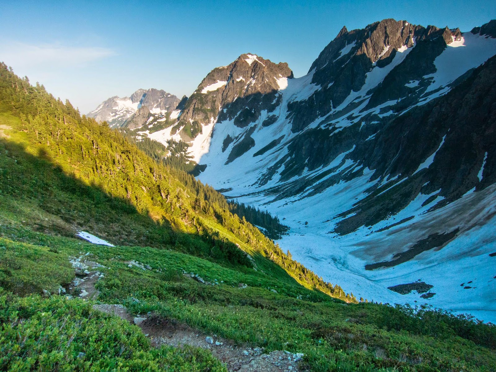
Cascade Pass was buried in snow. The view of Pelton Peak and Basin was amazing! My parents had hiked here years before and my dad has a framed picture from nearly the same spot. To my right I could see some climbers high up on a steep peak.

From the pass, I joined the Sahale Arm Trail and and switch-backed up. There was some snow on the trail, but the trail was well-used.

Looking back to Mix-up Peak


The views just kept getting better!


There was a great view of Sahale Mountain at the trail junction that went down to Doubtful Lake. I stayed up on the ridge.


Doubtful Lake

Stehekin Valley

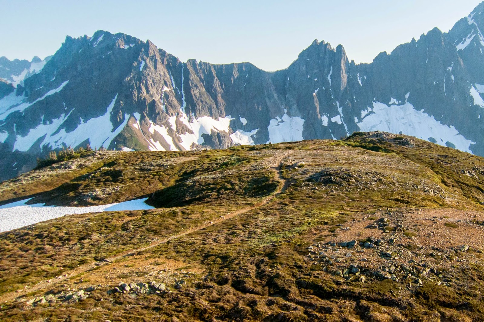
Sahale Arm


Mix-up Peak and the Triplets


I came to a great panorama of the Stehekin River Valey and many peaks!


The final ascent to Sahale Glacier Campground was steep.

I met some guys who were planning to camp and then climb Sahale Mountain in the morning. They had set their tent up inside a rockwall. We talked for a while.

I enjoyed some great food. The view was one of the best I have seen!
Sahale Arm and Doubtful Lake (and too many peaks to name!)

It was hard to pry myself from such a spectacular view but I knew I should try to make it back to the trailhead before dark.


On the way down I looked back to Sahale Mountain and Sahale Glacier.

Mix-up Peak and the Triplets


Sahale Mountain


Sahale Mountain and Doubtful Lake


The sun shown on the mountains as I neared Cascade Pass.

Cascade Pass


Looking back to Cascade Pass


Back on the switchbacks I ran down the excellent trail.
Johannesburg Mountain

I met a deer at one of the switchbacks and then another one (or the same one?) at a switchback farther down the trail.

Johannesburg Mountain

I made it back to back to the parking lot just as the sun was about to set.

This was a spectular day-hike! There are opportunities for backpacking farther into the park from the trailhead. Take the trail in Stehekin Valley and head east to the Pacific Crest Trail. Head south to High Bridge. This route is 23 miles and there is a shuttle.