April 30-May 1, 2016
~19 miles one-way
Of all the national scenic trails, I have currently hiked the most miles on the North Country Trail, a 4600 mile
trail from North Dakota to New York (soon Vermont). Whether it be beautiful segments in the Boundary Waters Canoe Area Wilderness (Border Route Trail, Kekekabic Trail), along Lake Superior's beautiful shoreline (Superior Hiking Trail, Pictured Rocks National Lakeshore), or in Michigan's Lower Peninsula (Manistee River, Jordan River Pathway), the NCT has provided exceptional backpacking opportunities.
With a travel PT job in southwest Michigan, I have had the opportunity to complete much of the established NCT in southern Michigan. While much of the NCT in southern Michigan includes lengthy road walks, there are still many excellent sections of trail.
During the weekend of April 30-May 1, 2016, I was able to complete a hike on the Baw Beese Trail and in the Lost Nation State Game Area. I also completed many short hikes of certified trail. (Post not yet completed.
This was a great hike including a scenic paved trail, short road walk and excellent trail in the Lost Nation State Game Area. Certainly one of my favorites in southern Michigan.
I started at the trailhead parking for the Baw Beese Trail at Barnard St and hiked north on the paved trail. I didn't bring much gear as I planned to return to my vehicle and continue hiking south.

The trail went past some impressive buildings.

The NCT online map just shows a road walk, but the Baw Beese Trail actually leaves the road and heads to the St Joseph River off of N West St.

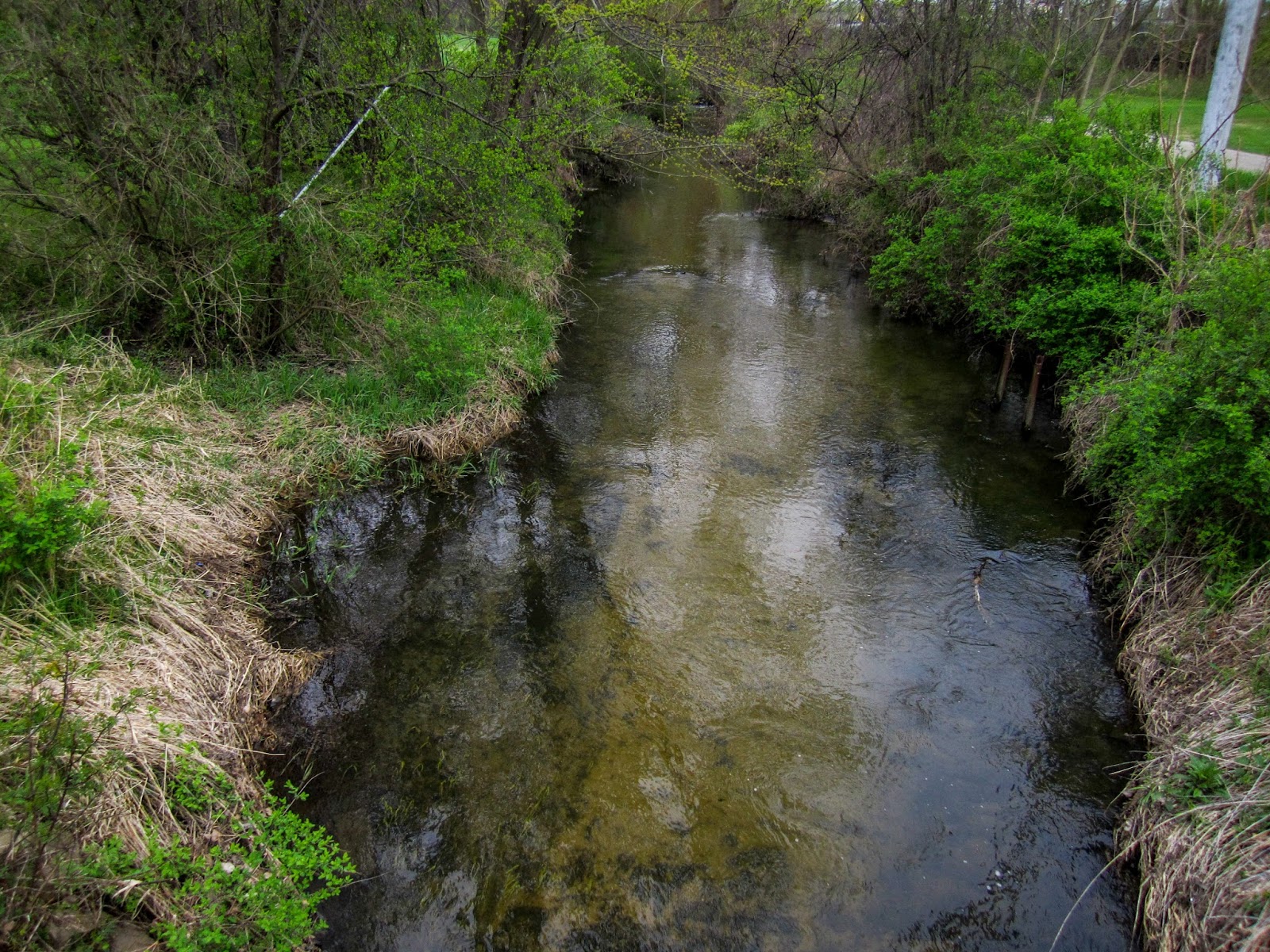
The trail is forested with the Indiana Northeastern Railroad to the west and the St. Joseph River to the East.

St. Joseph River


It was a scenic walk. There were several people out walking and running.


I crossed over the trail tracks and made my way to M-99.

The trail beside M-99 isn't much different than a road walk as it is a wide sidewalk.


There was a view across the train tracks of the area surrounding the St Joseph River.

I entered Jonesville.

As I passed a Walmart, I wondered if this was the easiest resupply opportunity on a National Scenic Trail.

I reached the end of the Baw Beese Trail at W Chicago Street.

A short distance to the east I discovered the future site of the Jonesville Rail Trail.

I decided to follow this trail on my return journey. It was parallel to the Baw Beese Trail.

It offered improved scenery near the river.


The trail ended at Beck Street and I followed it to reconnect with the Baw Beese Trail.

Back on the Baw Beese Trail

Soon I was back to the nice section by the river.


Baw Beese Trail through the forest


When the trail was back on the sidewalk, I found the Hillsdale County Mobile Command Center.


Soon I was back at my vehicle and I grabbed my pack and continued. It started to rain.

The area surrounding the trail became less populated as I made my way to Baw Beese Lake.

Baw Beese Lake


The paved Baw Beese Trail ended and I followed a gravel road beside the lake.

Soon I reached the end of the road and continued on a trail beside the lake.

I found the first blue blazes of the day.


Baw Beese Lake


I came to a road and saw my first NCT marker.

The trail was very straight.


After a quick road walk through Osseo, I made it to the Lost Nation State Game Area. I was quite excited, as I had planned to save the best for last.

The trail was in great shape and it felt great to be on an actual hiking trail.


I could see views of distant lakes through the trees.

I passed a skull in a tree.

I crossed the Otto Drain (I believe) on a scenic log bridge.


Next I came to the East Branch of the St. Joseph River, which the trail crosses several times.


I found some trillium nearby.


There was another excellent log crossing.


Some trillium were even pink.


I continued to enjoy the pleasant hike. I met a man out hunting for mushrooms.

I discovered that what the NCTA online map had indicated to be a road walk wasn't road anymore but now a wide trail.


The trail went past many scenic areas.

I came to a campsite near the trail.
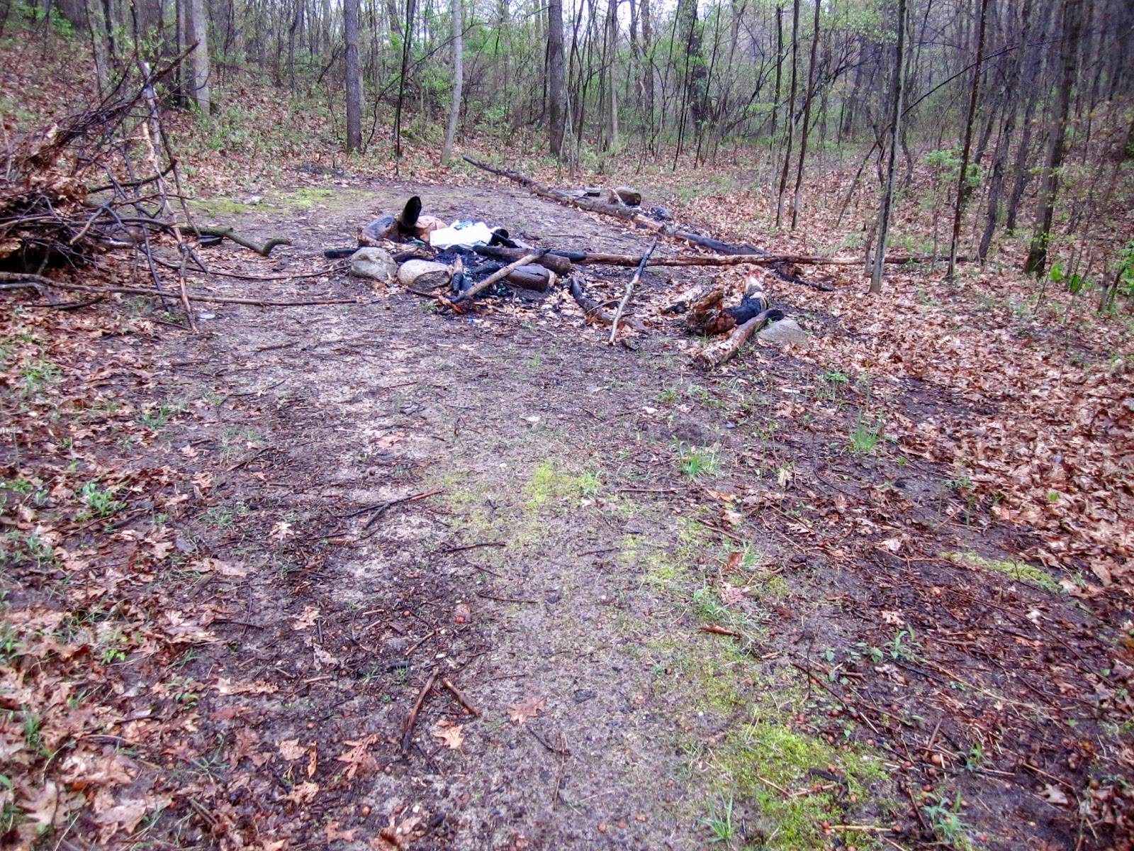
The campsite was near the E Branch of the St Joseph River and S Tripp Road.


I crossed over the bridge.


Then I hiked a short road walk. Someone's dog started barking at me but it wasn't agressive.

There was a great bridge to get back to the trail. Again, crossing the E Branch of the St. Joseph River.


The trail climbed up a hill for a nice view.


I came to Lake Number 5 which used to be a fairly large lake. The dam has since washed out and the lake is no more, but it was still a nice view.

All that remains is a small stream.

There was another short road walk.

I crossed the river again.

Then I came to a trailhead.


I came to Lake Number 8 and it was still raining.


This was one of my favorite places on the hike.

There was an impressive beaver dam at the end of the lake.


The trail followed the outlet and then crossed on a scenic and well-constructed bridge.

Nearby, I saw a couple guys who had set up camp at the campsite by the river.


It was still rainy and wet, but an enjoyable hike. The forest seemed to change and become more dense.

I crossed Skuse Road and continued on.

The trail went through an open area.


I found a helpful mile marker on a tree.

I came to another peaceful stream crossing.


The trail climbed up on a ridge and there were some great views through the forest.


I went past a survey marker.

Then I hiked through some flowers.

I reached S Pittsford Road and there was a large tree.

This is the furthest south of completed trail in Michigan I believe.


It was still raining and I decided to look for a place to camp.

As I came to the stream crossing, I looked to my left and found a relatively level spot above the water.

I set up camp and enjoyed a relaxing evening.


As I departed in the morning, I noticed some other blue blazes on the other side of the stream.

I followed them a short distance and found an old stream crossing.

I returned to the official NCT and continued back through the open area.


I came to the campsite I had seen occupied the previous day and it was empty.

It would be an excellent place to camp. I took a break and enjoyed the view. A fisherman walked by.


Nearby, I enjoyed the great view of Lake Number 8.


Lake Number 8

I saw a side trail and followed it up a hill and found another campsite.

It also provides a nice view.


Then I was back at Lake Number 5.


On the road walk, the same dog started barking at me again.


Then it was back to the road walk that is actually a trail.

More trillium


I continued the enjoy the remaining scenery in the Lost Nation State Game Area.


I left the game area and began the road walk back to the Baw Beese Trail.

Osseo

I came to the trail where it is really straight.

I crossed an old bridge.


I was tempted to take a break, but continued on.


Soon I could see Baw Beese Lake again.

Baw Beese Lake


I took a break on a bench with a great view of Baw Beese Lake.


From there it was a short distance back to my vehicle at Barnard Street.


Overall, this was a great hike. The trail was in great condition and the Lost Nation State Game Area feels quite similar to the NCT in northern Michigan. This is a true treasure in southern Michigan. Combined with the Baw Beese Trail, it is one of the only continuous sections (with little road walking) of NCT in southern Michigan. Nearly all other sections in southern Michigan have required piecing sections together in order to have sufficient miles without significant road walking for an overnight backpacking adventure. The other exception being the section between Middleville, Barry State Game Area, and Yankee Springs State Recreation Area. Thanks to all who helped make this beautiful section of trail what it is.
Eric,
ReplyDeleteI really enjoyed your blog. Photos and captions are fabulous...it's hard to believe a simple point and shoot camera can give such beautiful images. I happened across your blog after a Google search for the Colorado Trail near Lake City. My son is doing the CT east to west solo by mountain bike and is spending the nite at the Hostel in Lake City. He hopes to get to Durango in a few days and continue offroad to Moab over the next few weeks, then home via Amtrak to Winter Park, CO. He's also hoping the snow holds off while he's in the Rockies. Your beautiful pictures from your 2013 Colorado Trail hike gave me a good idea of what he's experiencing and makes me wish I were there. Thanks again for all your effort in putting your hikes on-line, and may you have many more.
Bill L.
Saint John, Indiana
Thanks Bill! Sometimes I wonder if all the work is worth it but the final result of benefitting others like you is quite rewarding. Hope your son has a great adventure!
DeleteThank you for posting this in such great detail! This is the best explanation of the Lost Nations/NCT trail section I have come across so far!
ReplyDelete