July 8 and July 22, 2015
~33 miles roundtrip
Of all the national scenic trails, I have currently hiked the most miles on the North Country Trail, a 4600 mile trail from North Dakota to New York (soon Vermont). Whether it be beautiful segments in the Boundary Waters Canoe Area Wilderness (Border Route Trail, Kekekabic Trail), along Lake Superior's beautiful shoreline (Superior Hiking Trail, Pictured Rocks National Lakeshore), or in Michigan's Lower Peninsula (Manistee River, Jordan River Pathway), the NCT has provided exceptional backpacking opportunities.
I will have time to hike a significant portion of trail this summer and coming fall in Michigan's northern Lower Peninsula. Section hiking the NCT's established trail in the Lower Peninsula is becoming a realistic goal.
There is a fine segment of trail between Doerr Road and Manistee Lake Road near Mancelona. It includes 3 scenic lakes, a pond, farmland, and forests. The northern end of this section is only a short roadwalk from the Jordan River Pathway and Landslide Overlook. The southern section is near a lengthy road walk to Kalkaska.
I completed this portion of trail with two out-and-back day-hikes starting in the middle from Sand Lake (different from the Sand Lakes Quiet Area).
See the map below:
7-8-15
Sand Lake to Doerr Road
13 miles roundtrip
After a short day at work, I began my hike on a short spur trail to Sand Lake.
Sand Lake
I hiked north on a deserted road walk.
Soon I was on official trail.
It was a pleasant walk through the forest.
To my left I enjoyed a nice view.
In some places it appeared that the trail was infrequently traveled. The trail was well marked, just seemed lightly used.
I did have one instance where the trail crossed a road and then disappeared into some ferns on the other side. I mistakenly followed a road on the other side for a short distance before realizing there were no more blue blazes.
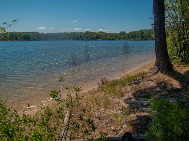
I reached Doerr Road and enjoyed a nice view of the lake pictured below. I'm not sure if it has a name.
On the way back through some ferns.
There was an interesting stump with a blue blaze.
Another section through some ferns.
Back through the trees!
Another great Michigan view!
There were many nice flowers along the trail.
I completed my hike with another great view at Sand Lake.
Back at Sand Lake
7-22-15
Sand Lake to Manistee Lake Road
~20 miles roundtrip
Again, this was after a short day of work. I started at Sand Lake and this time hiked south.
Joining the NCT
The trail stays by the edge of the lake.
Then I headed away from the lake into a section with some ferns.
Soon I was at Starvation Lake Road.
After a nice forested walk, I came to MacNeil Pond.
There was a family of ducks swimming.
A short distance away I came to Eagle Lake. This was a nice bench to take a break and relax.
Eagle Lake
I reached Manistee Lake Road and began my return hike.
This seemed like an interesting tree.
I took a short detour to the Pickerel Lake State Forest Campground to enjoy the view and see if I could find a pump for some water. I found a pump by the lake in the main parking lot.
Pickerel Lake
There was informative signage about the NCT. Thank you to Dennis for maintaining this section of trail.
A nice reflection at Eagle Lake
There were great evening views while hiking through a pine forest.
I decided to hike on Sand Lake Road (a sandy road) vs. the NCT and was rewarded with a great sunset view.
Back at Sand Lake, I enjoyed outstanding evening reflections.
Overall this was another fine section of the NCT in Michigan's Lower Peninsula. I enjoyed the variety of forests, farmland, and lakes. This section did seem lightly used as I didn't see another hiker the entire time. This is certainly an excellent day-hiking location or even backpacking as I understand that dispersed camping is allowed if following state forest regulations.


No comments:
Post a Comment