July 29-31, 2018

On my way west from Casper, Wyoming to Medford, Oregon for my next job I stopped to complete two separate hikes in western Wyoming. The first was this spectacular loop hike which is described in Douglas Lorain's book Backpacking Wyoming: From Towering Granite Peaks to Steaming Geyser Basins. The loop is 45.8 miles and includes 9300 feet of elevation gain and five passes.
The route can be shortened with a high clearance vehicle to get across several streams to the official trailhead. I parked as described in the guidebook on FR200.3 before it crosses Jojo Creek and walked the 6.9 miles to Kirwin.
View from where I parked near Jojo Creek

This is grizzly territory so I had bear spray with me.
Jojo Creek

It was a beautiful road walk. Several off road vehicles passed but it was a pleasant walk.

In some places the Wood River goes right through the road.


The road climbed up a ridge and I could see the river below.


There was some old mining equipment near the road.

dramatic rocky views


I reached the historic Kirwin townsite and a great view of Mt. Sniffel.


Kirwin

Kirwin Trailhead

My hike would include just a small portion of the Washakie Wilderness.


The views were outstanding!

In some places the trail was faint.

Looking down on Kirwin


As I climbed higher, there were many flowers.


I continued the climb and Greybull Pass came into view.


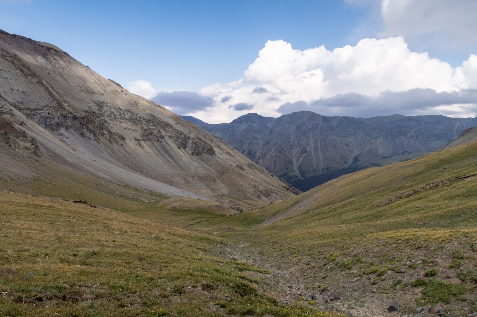

I reached the top of 11,500 foot Greybull Pass and found a great view of the Greybull River canyon on the other side.


I could see a herd of elk down below.

Looking back to my backpack on Greybull Pass.


Greybull Pass


It started to rain heavily, so I quickly began the steep descent.

Greybull River

Elk

The elk saw me and started to run away. There were probably at least 50 of them.


Greybull River

Looking back up to Greybull Pass


Elk

I came to an old miner's cabin near near Yellow Creek.


The scenery was great. I passed a large group of people on horses who were going the opposite direction.


I continued along the Greybull River with dramatic views.


I reached a trail junction with the trail up Steer Creek.

Next I crossed the Greybull River.


I found a campsite near the Greybull River that was sheltered in the trees and offered a nice view.


My campsite in the trees.

I went to the river to get some water and there was nice evening light on the towering mountains above.

Greybull River


The forest nearby had been burned but there were colorful flowers.


The next morning I awoke to morning light on the opposite side of the river.


It was a chilly morning and I continued along the Greybull River.


I crossed the Greybull River and began following Cow Creek.


The trail climbed upward to Burwell Pass.


There was still snow in places but I didn't have to hike on much of it.


Burwell Pass


I began the short descent, knowing that I still planned for three more passes for the day.

It was a beautiful descent along a ridge.

Switchbacks visible faintly

Looking back to Burwell Pass


I began the climb up to an unnamed pass at 10,950 feet.


Pass 10,950


There were uniquely colored mountains.


The trail went through a fire burned area.


I could see a waterfall down below.


There were many different flowers.


I climbed up toward the third pass of the day.


Another colorful mountain


I reached the third pass at 11,040 feet and took a break.


The descent was across a grassy slope with trail hard to discern.


There were posts and cairns to mark the way but no trail tread.


I joined the Bear Creek Trail.

Bear Creek was silty.

I hiked past some interesting rock formations on my way up Bear Creek Pass.


Looking up to Bear Creek Pass


There was a great view from the top of the pass.


Looking back to Bear Creek Pass


I descended to the Wood River.


Wood River


I found a beautiful place to camp near the Wood River.


The next morning, it was a quick hike back to Kirwin.


As I neared Kirwin, there was an interesting building.


I crossed a bridge to explore more of Kirwin.


Kirwin


I began the roadwalk back to my car.


I made it back to my car with time to drive to my next hike in the Gros Ventre Wilderness.

Overall, this was a spectacular loop. The scenery was some of the best that I have seen. This hike was different from others I have done in Wyoming as there weren't any lakes, but the canyons, mountains, and wildlife make this one of my most memorable hikes.
Hi Eric, I am part owner of a backpacking tour company and we recently acquired permits to guide this trip on occasion. Any chance we could figure out an agreement to use some of your photos? We scouted the trip in October and everything was much browner than in summer, which isn't surprising. We love your green, vibrant photos. If you're willing, please email me at scott[dot]cundy[at]wildlandtrekking.com and we can discuss. I appreciate your time. -Scott
ReplyDeleteGreat backpack description. Thank you. It sounds like the trail fades out occasionally. Was the backpack still pretty easy to follow? This area is suppose to have a lot of Grizzly bears. Did you see any on you backpack? Thank you.
ReplyDeleteYeah the trail is faint, but not too hard for me with a gps track. I didn't see any griz but had bear spray ready. I think there might be more bears in the North Absorakas but I haven't been there and this was my first time here.
DeleteEric,
ReplyDeleteFabulous video. Loved it. Beautiful photography and super song selection. Thanks for sharing this and letting your faith shine through. Well done. Rollie
Thanks Rollie! Blessings :)
DeleteYou covered a lot of ground on day 2! We did this trip in 2021 with the addition of going up Cascade Creek and traversing over the ridge and down East Fork pass to pick up the loop. Beautiful country - we saw bighorn sheep, elk, whitetail and mule deer, and even a moose on the walk back to Jojo trailhead.
ReplyDeleteThinking of doing this loop with horses. Do you think there would be enough graze and water on this loop? Beautiful country thanks for posting.
ReplyDeleteI think you would be ok but probably best to check with Forest service ranger. It’s been a few years and conditions may have change. I do remember a lot of horses camped nearby as I was almost done with the loop but not sure where they were going:)
DeleteThank-you for your reply - I appreciate your time and input.
ReplyDelete