July 6-8, 2018
This was a weekend backpacking trip in the Wind Rivers near Lander, WY. This was my first time returning to the Winds since I did a high route with my brother in 2015 and they were just as spectacular as I remembered.
I followed most of the route hike #20 described in Douglas Lorain's Backpacking Wyoming book. I hiked clockwise with campsites at Stough Lakes and Deep Creek Lakes. The loop has several side trips that provide the best scenery of the hike. I didn't calculate specifically but I hiked ~40+ miles.

I had a short day of work on Friday and after a three hour drive, I arrived at the Worthen Meadow Trailhead in the late afternoon.

I joined the Stough Lakes Trail across the road from the parking lot.

In a short distance I entered the Popo Agie Wilderness.


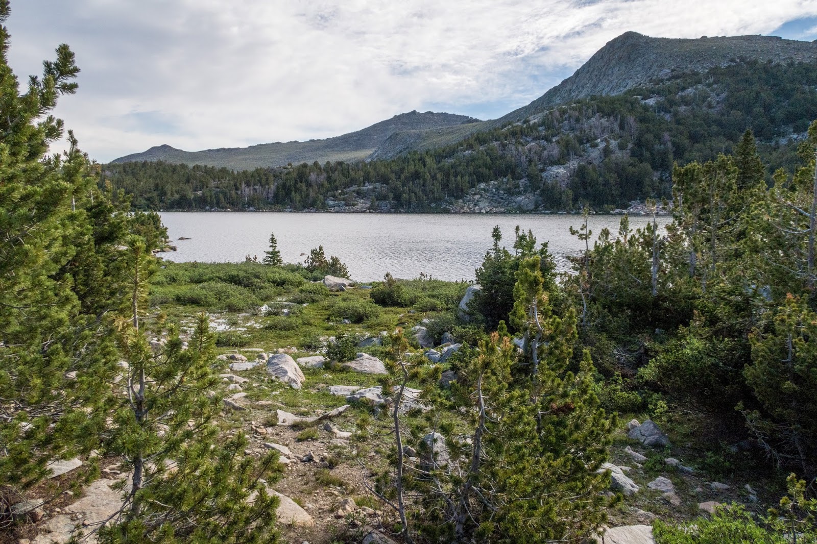
I arrived at Roaring Fork Lake and was rewarded with a nice view.

Roaring Fork Lake

I crossed a stream and there was a large group camping at a nearby campsite. The trail climbed upward toward an unnamed pass. There was a boardwalk across a scenic meadow.

The trail switchbacked up through a rocky area.

I could see the reservoir down below through the trees.


As I reached the pass, there was a small amount of snow remaining.

The pass at 10,535 feet provided an excellent view of Wind River Peak.

Wind River Peak


From the pass the trail descended and there were open views of many mountains.


The trail went back in the forest.

I hiked past some ponds and kept my eye out for wildlife.


I reached Stough Creek.

I reached the trail junction to the Stough Lakes basin.

There was a bridge across Stough Creek.

The trail climbed up and I could see Roaring Fork Mountain above the trees.


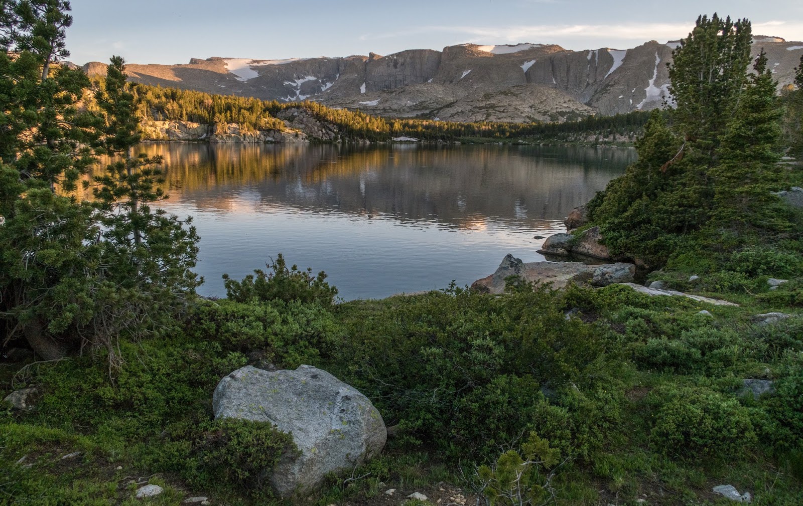
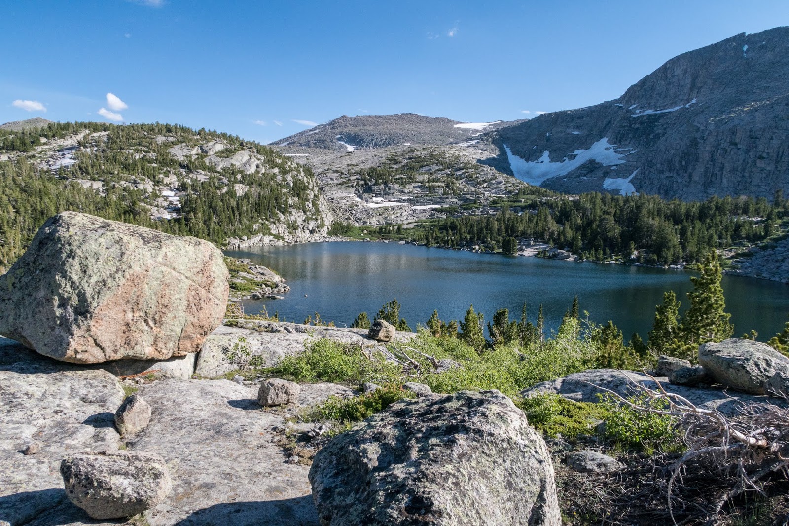
I made it to the lowest Stough Creek Lake, Lake 10484, and decided to look for a place to camp.

Lake 10484

I went to the left and looked for a place up the ridge away from the water.

I saw a tent and continued to a place near the outlet of the lake.

There was nice evening light at the lake's outlet.

Then there was a pleasant reflection of Roaring Fork Mountain in the lake.
Lake 10484

My campsite above the lake had a nice view.

There were clouds of mosquitos, but they didn't bother me much as I appreciated the view.

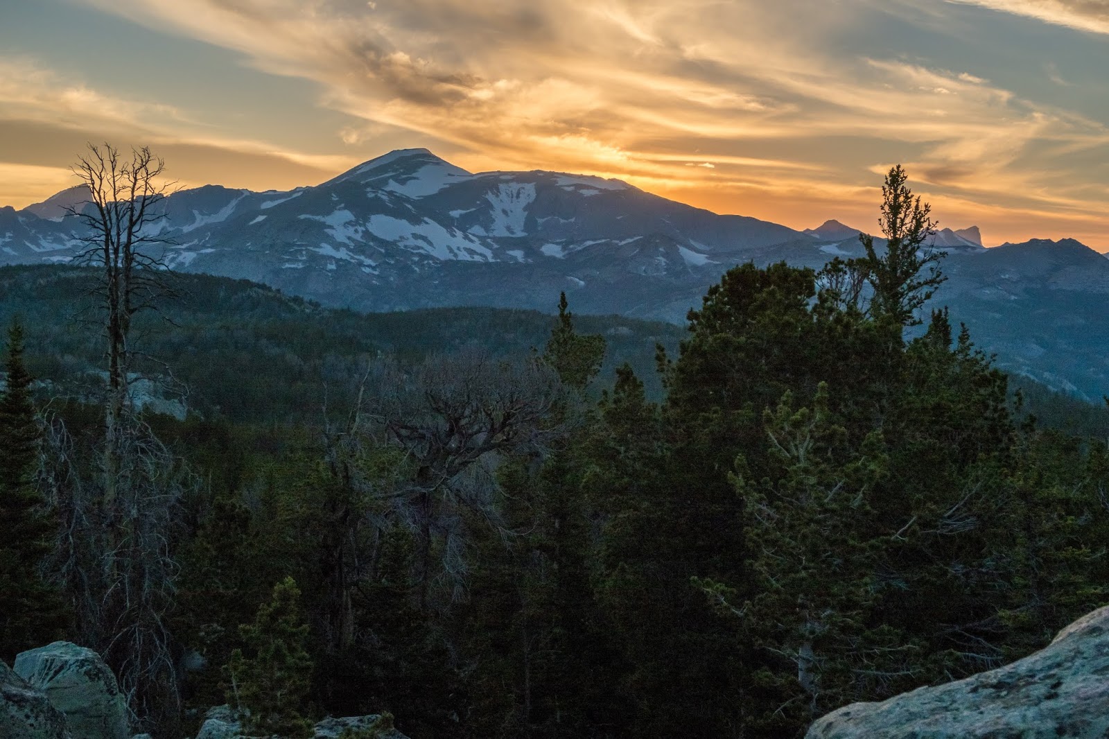
I saw bright clouds behind me over the ridge. I climbed up to see and was surprised to find a wonderful view of Wind River Peak.


I walked over to a rocky outcropping and ate some food while enjoying the view.

I went back to camp to get my little tripod for a time-lapse.


The clouds darkened and then became very colorful after the sunset.


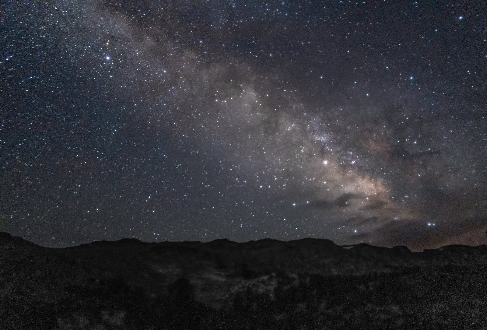
Back at the lake it was dark, but I decided to take some longer exposures of the lake and Roaring Fork Mountain.

Outlet from Lake 10484

I awoke fairly early with the sun beginning to color the mountains.


Soon I packed up and began hiking up the Stough Creek Lakes Basin.


Looking back.

Much of the hiking in the Stough Lakes is off-trail, but navigation is pretty easy.

I decided to go up to one of the highest lakes in the basin.


There were dramatic cliffs and the hiking was easy.

There was a great view to the west.


I skirted past Stough Creek Lake and climbed up to one the highest lakes.

There were many jagged cliffs.

There was a great view from the upper lake. I took a break to eat some food.


I began my descent back the way I had come. Looking down on Stough Creek Lake


Stough Creek Lake


There were many other lakes to the west that I didn't have time to fully explore.


Soon I was back on the trail and back at Stough Creek where I resumed the loop.


I followed the trail to Bill's Park and the Middle Fork of the Popo Agie River.


Middle Popo Agie River


There was a scenic crossing of the Middle Popo Agie River.

I decided to take another side trip off the loop to Tayo Lake.


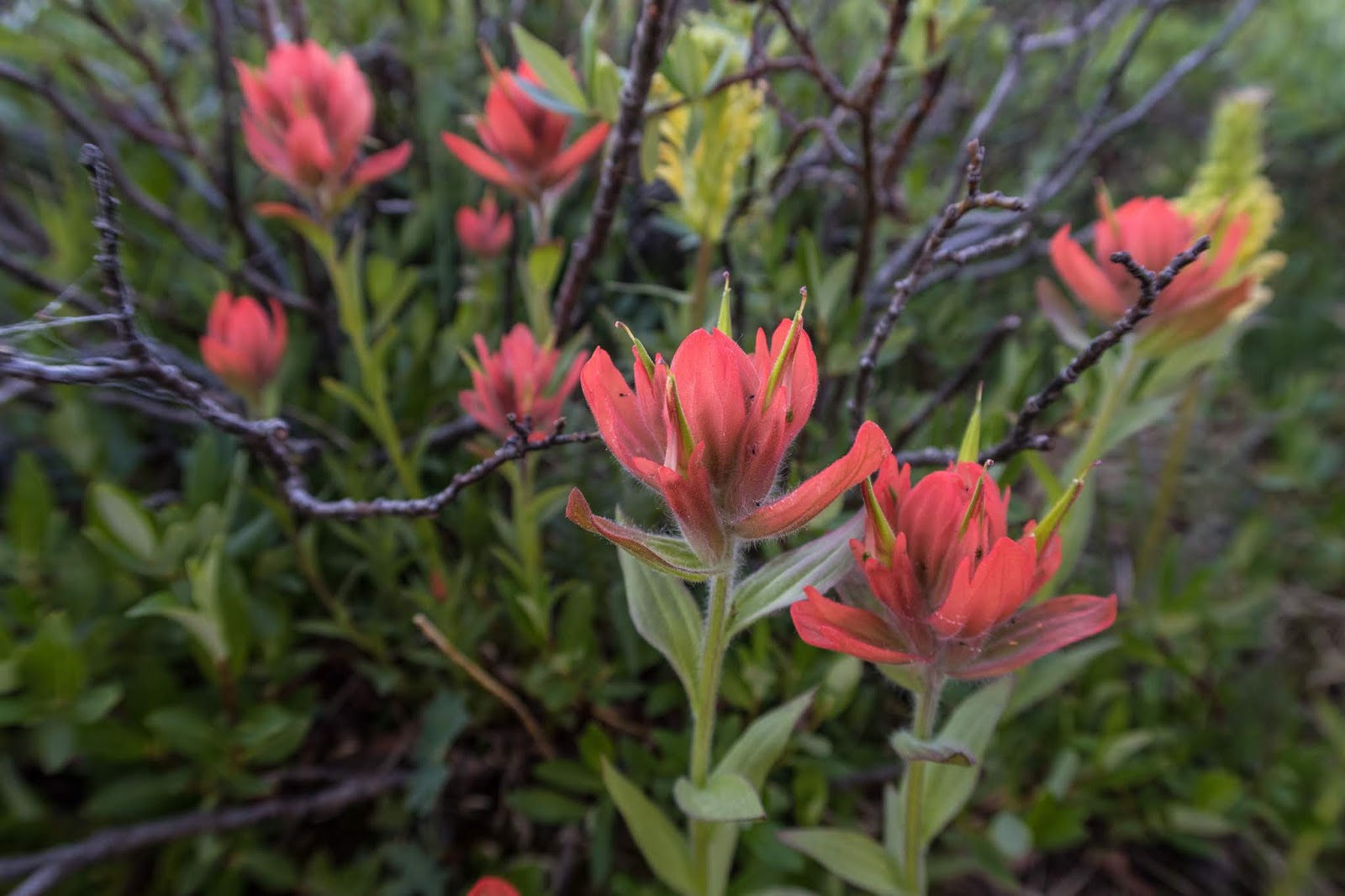
There were many flowers along the trail.


I took a break at Poison Lake.


There was another trail to Coon Lake but I didn't think I had time to see it.


The trail to Tayo Lake was faint in places.

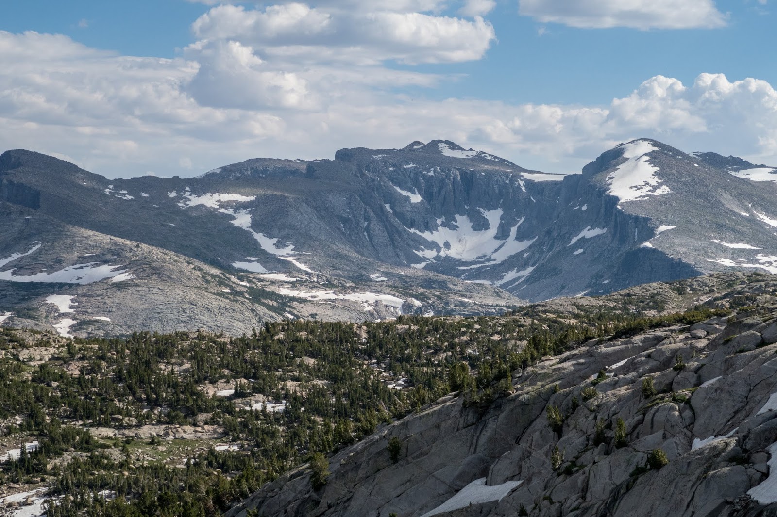
Tayo Lake

Tayo Lake provided an excellent panoramic view including Wind River Peak to the right which the guidebook states can be summited from here.

Tayo Lake


Tayo Lake


I began the hike down and back to the loop.


Poison Lake


Returning to the loop, I continued on the Ice Lakes Trail.


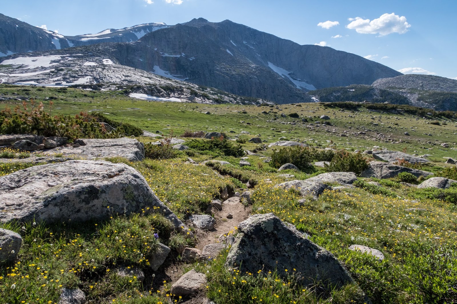
I enjoyed a break at a scenic meadow before I began a climb up to a couple of unnamed passes.


Through the trees I could see the first pass which appeared snow covered.


The trail was rocky.


There was nice view as I neared the pass.

The trail wasn't covered in snow.


View from the pass

The trail descended a little from the pass before climbing up to the next pass which also appeared covered in snow.


The trail was well constructed and avoided the snow covered areas.

There were great views of distant peaks.

I reached the top of the pass and entered the Ice Lakes Basin.


I descended down to the Ice Lakes but was starting to feel tired so I didn't get to explore many of them.


Boot Lake


One of the Ice Lakes


I continued to Deep Creek Lakes.


The trail went beside a cliff with lots of snow.


I reached the lower Deep Creek Lake.


I spent some time searching for a place to camp as most of the area away from the water was covered with snow in the forest.

There was a little evening light on the peak behind the ridge.


There was a scenic view from the outlet of Deep Creek.

My campsite in the trees

There was better light in the morning and blue skies.


I hiked up to Lake 10577.


There were many nice campsites on the side of the lower Deep Creek Lake. If I would have known, I would have camped here.

Looking back at the lower Deep Creek Lake

There was a dramatic view from Lake 10577.


Lake 10577

I began the return route to the lower Deep Creek Lake.

I joined the cutoff trail along Deep Creek.

Much of the remainder of the hike was descending through the forest.

I passed a small lake and could still see some snow covered mountains.


There were still some great views from rock outcroppings along the trail.


I hiked beside some impressive cliffs.


I reached the Middle Popo Agie River again and the trail descended beside it.

The Middle Popo Agie was quite powerful in places.


I saw a small snake enjoying the warmth on a rock.

It was starting to got hot out and there wasn't much shade.


Middle Popo Agie River

There were nice flowers.

I came to the junction for Twin Lakes and continued back to Worthen Meadow Reservoir.

The trail climbed up through the forest.


As the trail began to descend to the trailhead I enjoyed some of the final views of the mountains on the hike.


I crossed a small bridge and soon I was back at the trailhead.

I was able to give a ride to another hiker back to Lander, who had previously hiked the John Muir Trail as well. I had hoped to explore some of the sights in Sinks Canyon on the way down but hopefully will be able to come back sometime.
Overall this hike was an excellent hike in the Wind Rivers. The Winds are one of my favorite mountain ranges. This route was nearly all easy hiking which was a contrast to the high route I did previously. The easier hiking did mean increased hiking in the forest, but overall the mountain scenery of the Winds is hard to beat. I was surprised to see only a handful of others on the trail. I expected less solitude, but it was still fairly early in the hiking season. I did see a group hiking with llamas! The Winds have so many other places to explore. I really enjoyed how this loop included side trips to remote basins and lakes.
Another great report! I'm planning on doing Stough here soon enough. Really appreciate the map you've made that lets you click on the hiking locations—never seen that done before!
ReplyDeleteThanks Luke! Have a great adventure!
DeleteGreat photos and report! Planning on doing the route counterclockwise mid-September with just a side day hike to climb Wind River Peak. Hoping to do it in 4 days.
ReplyDeleteCamped at Lower Deep Ck L a few years ago. Plenty of legal sites nearer the shore and on other side of trail in the trees. Not sure yet if I should camp off of Ice L trail to ascend peak without full packs.
Thanks, you might be able to camp at Poison Lake and then day-hike Wind River Peak from there passing Tayo Lake. I drank the water so it probably isn’t poisonous haha. Have a great hike!
DeleteHello, Thank you so much for sharing photos and thoughts from your adventures - I love to read about others adventures, and it is an awesome research tool! I am actually planning this loop for the coming season. I wanted to ask your thoughts on which direction to hike the loop, if you did it again would you hike it the same direction, clockwise? The guide books that I can find this loop in suggest doing it clockwise, but it seems like going counterclockwise might be more gradual? I'd love to know your thoughts! Thank you!
ReplyDeleteI think I went clockwise based off where I wanted to camp. I knew I wouldn't have a full day the first day so going clockwise would get me to Stough Lakes. I think you're right that it would be more gradual going counter clockwise. Either way is going to be really beautiful!
DeleteNice write up.
ReplyDeleteمقال رائع عن Eric's Hikes: Wind Rivers: Stough Lakes and Middle Popo Agie Loop! استفدت جدًا من المعلومات.
ReplyDelete