June 30-July 1, 2018
This was a one-night ~16 mile loop including spectacular mountain scenery and many lakes with some off-trail hiking. Almost the entire route is in the Cloud Peak Wilderness. The trailhead is located near Buffalo, Wyoming. A free self-issued permit is needed at the trailhead. There are no fees necessary.

The route I completed is as follows: Circle Park Trailhead>TR 46>Sherd Lake>TR 95 for the eastern portion of the loop>TR 46 past Her Lake>TR 90 to Old Crow Lake> Off-trail to Lame Deer Lake (camp)>near Lower Chill Lake> back to Old Crow Lake> TR 46 to Rainy Lake> out and back on TR 87 to Willow Lake>TR 46 back to Circle Park Trailhead.
Circle Park Trailhead

I began the hike in the afternoon after about a 2 hour drive in the rain. It was cloudy but the rain had stopped. The temperature was in the high 40s.

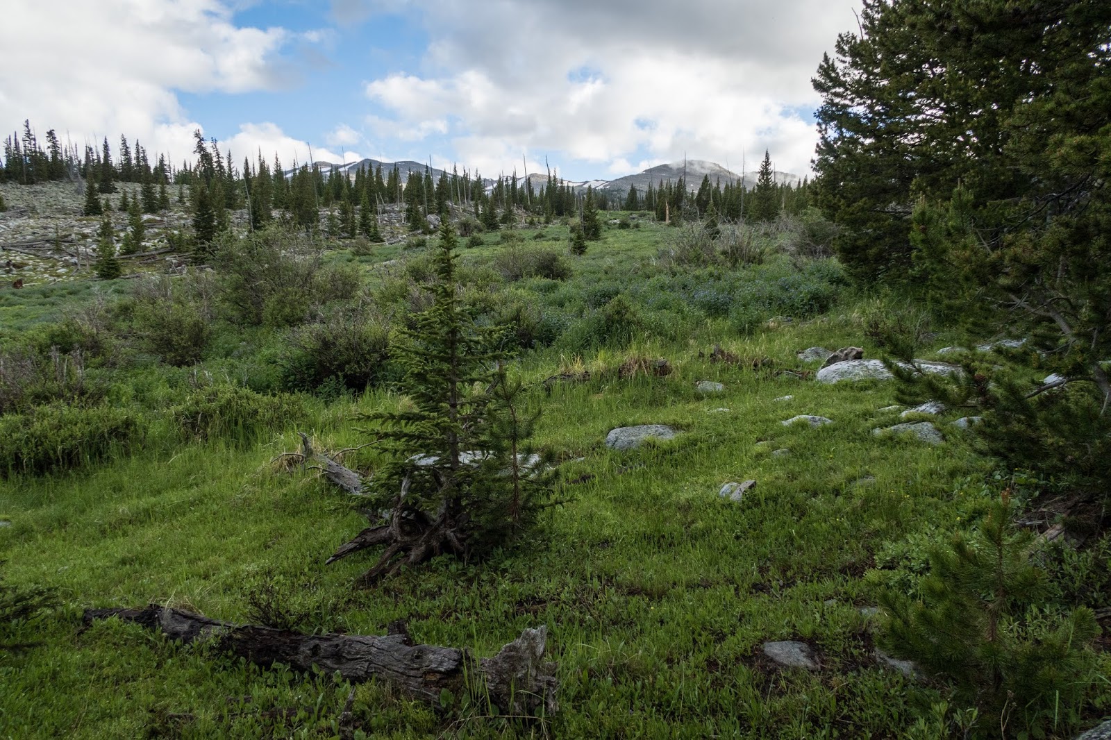
The trail quickly went through a meadow with many flowers.


The trail was wide and rocky.

Soon I entered the Cloud Peak Wilderness.


The trail in this area was mostly forested but I passed a few scenic ponds.


I passed a couple day-hikers as I hiked. Soon I was at Sherd Lake with a nice reflection.


I turned left at the lake and continued on TR 95. I could just barely start to see some mountains through the trees and the clouds.


A peaceful pond with a beaver lodge

In some places the terrain was quite rocky.

The sun started to shine as I came to a small lake.

I crossed a swiftly flowing stream from the lake's outlet on two small logs.


Off in the distance I could see what appeared to be cliffs on a small hill.

I crossed a boardwalk through a swampy area. I watched for wildlife. Maybe I would see a moose.

Near the trail junction for TR 46 there were many flowers.


The trail climbed up and the views improved. Somewhere along this stretch there was another side trail that I followed for a little ways but I didn't go to the end. TR 46 seems to have missed Trigger Lake unlike what my map indicated so maybe that's where the other trail goes.


The trail crossing near Her Lake was moving faster than I liked so I decided to cross up stream.

I was rewarded with a view of the mountains in the clouds.


Soon I reached Old Crow Lake and the view was even better.

Old Crow Lake

I could see Bighorn Peak, there was a beautiful reflection, and I could see some tents at a great campsite.


I went off trail, making my way up to Lame Deer Lake.
At times there was a small trail in the forest, but often I followed the creek from Lake Deer Lake. Walking through the vegetation made feet wet.

There was a dramatic view of Bighorn Peak, which was still fairly snow covered on the last day of June.


As I neared Lame Deer Lake, I made my way across a boulder field.


Looking back at the boulder field

Near Lame Deer Lake there was some snow.

I arrived at Lame Deer Lake and found a beautiful reflection of Bighorn Peak.

Lame Deer Lake

I scouted out for a place to camp and was able to find a fairly level spot back in the trees. Much of the area was rocky. I was surprised to find another tent a short distance away, but I didn't see anyone.


Campsite near Lame Deer Lake

There wasn't a spectacular evening view of the mountain, but there was a small sunset over the mountains.


Evening light shown on a peak through the trees from my campsite.

After a good night's rest, I awoke to a pleasant but chilly morning.


I was hiking by ~7am and continued off-trail up to higher elevation.

I followed the southeastern side of Lake Deer Lake in the forest. At times there was a trail to follow.

At the southern tip of the lake there were several nice campsites.

Lame Deer Lake looking northeast

I continued upward hopping from rock to rock.


Looking back to Lame Deer Lake


I reached a small unnamed lake and decided to follow the northern side for a better view of the mountains.


There was some nice light on Bighorn Peak.

The off-trail hiking was slow going and I had to be careful as some of the boulders weren't stable and would tilt when I stood on them.


One of the Chill Lakes


There were impressive cliffs at the end of the basin for the Chill Lakes.


I considered going a little farther, but decided I was quite satisfied with the views I had seen and decided to turn around and start making my way back to Old Crow Lake.


Lame Deer Lake


Lame Deer Lake


Sometime on the descent I took a pretty good fall when I twisted my ankle on a rock or log, but I mainly just landed on my back on my backpack. It reminded me that nearly every step while off-trail hiking could be dangerous.

Old Crow Lake


I rejoined the trail and continued on the loop.

Otter Lake

At Rainy Lake, there was a pleasant view. I met a couple hikers who stated they had just been at Willow Lake and said it didn't have a mountainous view.


Rainy Lake

I decided to go see Willow Lake for myself.


The trail climbed up on a ridge with some flowers.

After a descent, I arrived at a lookout of Willow Lake.

I decided to scramble down to the lake level on the eastern end.

I imagine the other hikers I met weren't able to see this view from Willow Lake. It was definitely worth the side trip to see this view.

Willow Lake

I began the return trip to Rainy Lake.

There was nice trail through the forest. I passed a ranger doing trail work, fighting a blowdown that was over the trail with his saw. Many thanks to all who help maintain trails.

Rainy Lake

I continued around the loop and soon reached Sherd Lake again.

Sherd Lake

It was a short hike back to the trailhead and soon the hike was complete.


While driving away I was surprised to see many more mountains than I did when driving in. Previously they were in the clouds.

This hike exceeded my expectations. The loop portion by itself was pleasant but not particularly remarkable. The off-trail sections, with relatively easy navigation, provided a wild feeling similar to the Wind Rivers with towering cliffs, boulder fields, and beautiful alpine lakes. Overall, this hike makes me want to explore more of the Bighorns in the future.
Fantastic report! Very glad to see this blog. I was considering this exact hike, and now I will. I've done Powell Lakes, Frozen Lakes, and Cloud Peak Lakes up in the Bighorns this summer, and Temple Basin and Dinwoody Basin in the Winds, too. I'll add Chill Lakes starting tomorrow.
ReplyDeleteThanks, Eric! God bless!
Thanks Lucas! Sounds like you’ve had an adventurous summer. Have a great hike!
DeleteBlessings, Eric