August 26, 2016
Pre-hike
After finishing a great travel PT job I was at the Detroit airport by mid-morning the next day. The first flight was to Toronto where I met up with my twin brother Andrew who was coming from his home in Maryland. This would be our second annual adventure after hiking the Wind River High Route last year. We had a connection in Halifax.

We arrived at Deer Lake and it was already late in the evening as Newfoundland time is 1.5 hours ahead of Eastern Time.

There was a phone near the baggage claim with a direct line to the nearby taxi service. We soon were at our hotel in Corner Brook and ordered a huge pizza.

August 27, 2016
~10 miles
Paul Wylezol, chairperson for the IAT, had offered to provide a ride to the remote southern trail head in the Lewis Hills (we paid gas). The road was quite rugged in places and provided many excellent views. Paul stated that thru-hikers often unfortunately use the road and bypass many of the wonders that are so close along the UltramaTrex.

Unloading gear at the Southern Trail head in Lewis Hills

Before hitting the trail, Paul went over route specifics and took our photo. Many thanks for all the help, Paul!

Much of the UltramaTrex is off-trail travel, but trail is typically cut in the forested sections.

The trail is typically marked with pink ribbon.

At times, there are posts to guide the way as was the case the majority of the first day all the way to the Cabox, Newfoundland's highest point.

We enjoyed our first views of the Lewis Hills.


It was pleasant walking, but the trail was wet and muddy from rain the previous night. Wet conditions were prevalent along nearly the entirety of the route.

We passed several ponds on the way to the Fox Island River Valley.


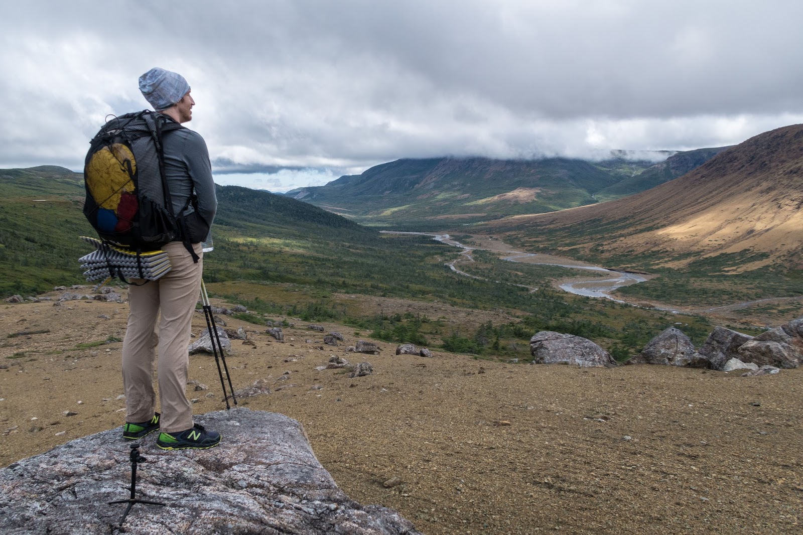
As we viewed the dramatic scenery in the distance, we wondered where this amazing route was going to take us.


We started to get some great views of the Fox Island River Valley.


Fox Island River
We took a quick detour and climbed up higher for a bigger view.


Then we began our descent to the river.


The river is quite wide and was an easy ford at this time of the year.


We started to see many interesting rocks as we began our climb up on the other side.

There were many scenic cascading waterfalls.


The scenery was quite dramatic and quite different from anything I have experienced before.


An interesting rock


It was a fairly strenuous climb, but the route was well marked.


The route briefly turned and we were provided with a very expansive view of the Lewis Hills.


As we continued our climb to the Cabox, we were excited to find a spectacular view of the Gulf of St. Lawrence.


We also encountered our first two caribou.


We reached the top of the Cabox and there was a broken monument.

There was a great view!

Panorama from near the top of the Cabox


Down below we could see many more caribou.

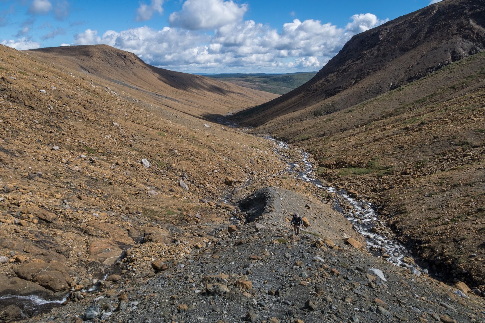
We began making our way over to Molly Ann Gulch.


There were many pleasant streams and waterfalls on the way.


We started to see our first views of Molly Ann Gulch in the distance.


It was getting late in the evening and we began to look for a place to camp.


Molly Ann Gulch

We found a perfect campsite overlooking the impressive gulch with towering waterfalls visible in the distance.


Campsite above Molly Ann Gulch


It was a clear night and the moon was not visible so I attempted to take some of my first star/milky way photos with parameters my dad had instructed.
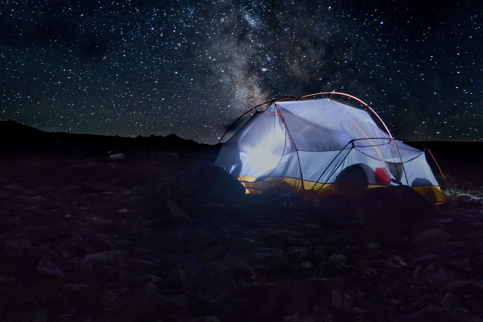

Pictures are awesome!!! :)
ReplyDeleteHey there! I was wondering if you could tell me a few things about this hike? I haven't been able to find too much info, but I did come across your page! My email is CampbellLisa55@gmail.com if you get a chance. Thanks a ton!
ReplyDelete