This is Part 3 of 6 of my NCT/Lake Superior Adventure.
Otter Lake Road to Gunflint Trail (6.75+18.67+17.84+16.29+7.0=66.55)
Cumulative NCT/Lake Superior Adventure miles: 524.2 miles
Campsites:
Near Pigeon River
Gogebic Lake
South Lake
Gunflint Lodge
Day 1 Otter Lake Road to Pigeon River: (6.75)
I began my Border Route Trail Thru-hike while simultaneously finishing my Superior Hiking Trail thru-hike.

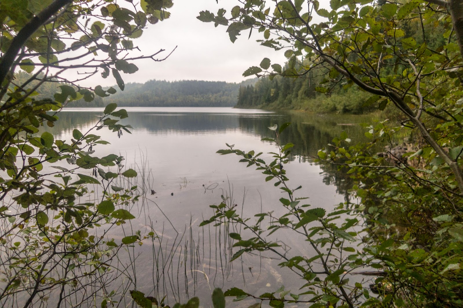
The trail was in good condition and I quickly reached the 270 degree overlook of the Pigeon River, Swamp River and Canada. The Pigeon River is the US/Canada border. The Border Route Trail stays relatively close all the way to its headwaters to the west near Mountain Lake.
Pigeon River

The Swamp River heads south to Devil Track Lake and becomes the Devil Track River, one of the many scenic rivers that I crossed on the Superior Hiking Trail.
Swamp River

The end of the Superior Hiking Trail

After leaving the overlook I continued solely on the Border Route Trail. I could see that it had some more undergrowth but was easy to follow. Blue ribbons mark the trail.

After only a few feet, I found a skeleton.

The tread was soft and made for excellent hiking.

I loved the views from the ridge!

The river down below!


Typical trail conditions

There were even signs directing me in the right direction. In some places all that would be left was the green post.

Portage Brook

There was a primitive campsite nearby, and then I crossed Portage Brook.


Here is the bridge over the the Stump River. I actually went the wrong way after crossing the bridge and ending up walking down a road for a short period. After not seeing a blue ribbon for a while, I decided that this walking was too easy to be the BRT, so I ran back to the bridge and found the real trail. I should have turned right after crossing the bridge.

The trail then headed north to the Pigeon River and I found a small spot to set up my tent.
Day 2
Pigeon River to Gogebic Lake (18.67 miles)
Pigeon River with Canada on the other side

The BRT climbed up a ridge overlooking the Pigeon River. From here I accidentally ended up on a short spur trail (pink ribbons) that took me to a road. The trail was no where on the other side and hadn't seemed as well maintained so I returned back to the overlook and found the trail. From this and the experience the day before, I learned that it was best to make sure I was on the BRT and not some random trail before hiking too far.

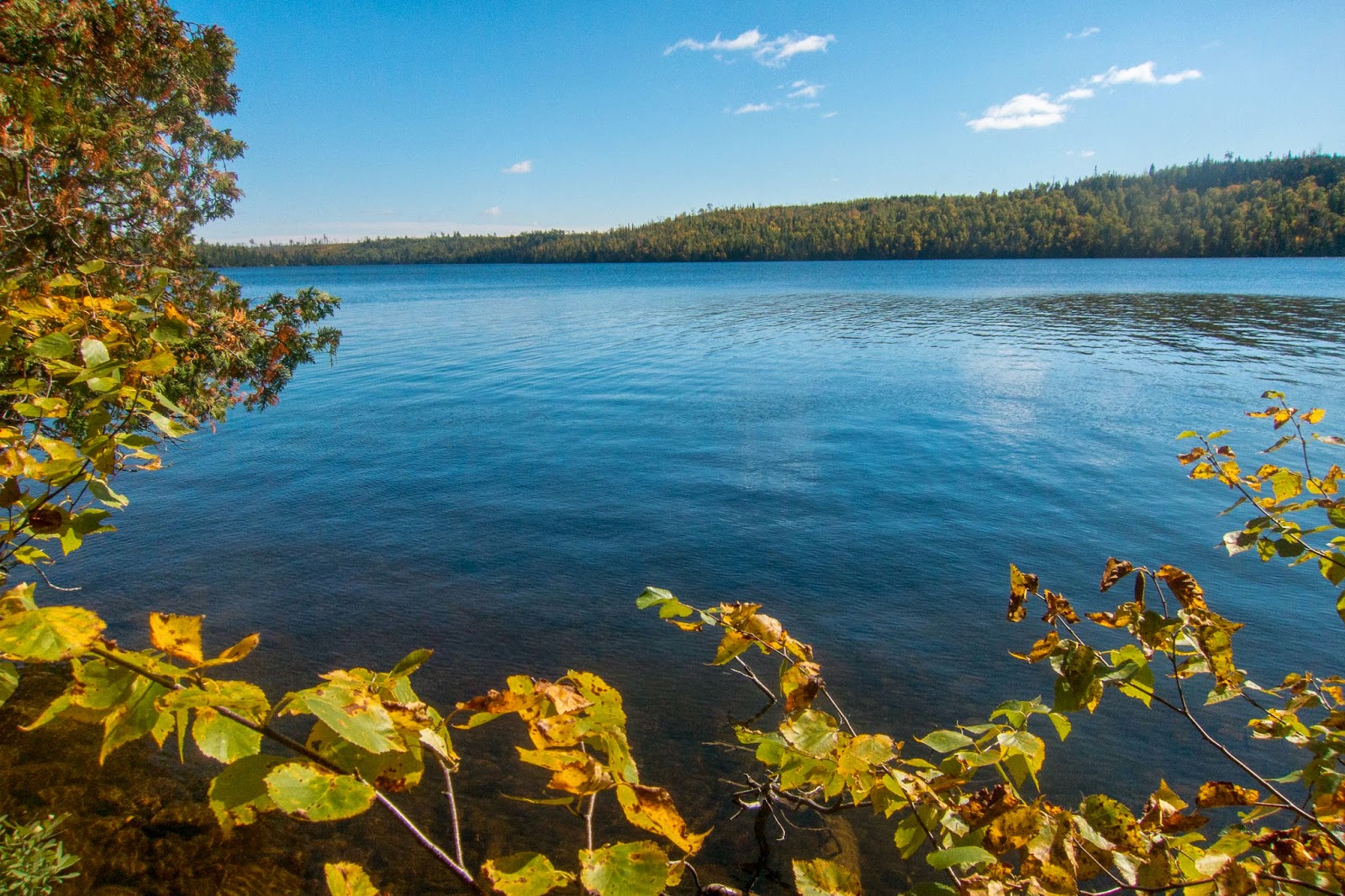
In less than an hour I came to my first view of South Fowl Lake. The Pigeon River flows out of South Fowl Lake after draining from several lakes in the Boundary Waters.

In a different direction I had the view below.

South Fowl Lake

There were several amazing overlooks that left me in awe.


The trail was becoming thicker but actually easier to discern than it looks.


I came to the parking area by McFarland Lake. I met four guys just heading out on a day-hike to where I had just been. I told them of the great views and that the trail wasn't that hard to follow. The BRT continues across the bridge over the flow from McFarland Lake to Little John Lake.

There was a brief road walk to connect to the trail on the other side.

In a little over a half mile I entered the Boundary Water Canoe Area Wilderness (unmarked) and then continued uphill to a view of John Lake. I took a short break here to eat some food.


The trail for the most part was in great shape. There probably were places where I had to detour around fallen trees but nothing that slowed me significantly that I recall.

I continued on in the woods until I came to a great view of West Pike Lake and its island.


I made my way to Gogebic Lake. The trees thinned out a little in some places but I missed some of the overlooks on the map or maybe trees have just grown.

The trail loops around the western side of Gogebic Lake and I came to a nice campsite on its western shore.

Gogebic Lake


Day 3
Gogebic Lake to South Lake (17.84 miles)
This day provided some of the finest scenery of my entire NCT/Lake Superior Adventure. It was my favorite day on the BRT including highlights of Mountain, Watap, Rose, and South Lakes.
Early in the day I came to the Clearwater stream bridge and took a short detour down the portage to West Pike Lake. It is significantly larger than Gogebic Lake.
West Pike Lake


I took a short detour to explore the campsite by the east end of Clearwater Lake.

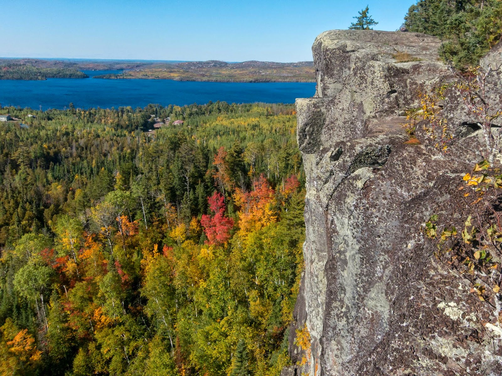
As I continued to hike, I came to some impressive views of Mountain Lake.


There were many rocky cliff overlooks and I took time to explore. Some of them I was able to find by looking at pictures in the guidebook. The picture below is the same as the one in the guidebook except that the guidebook has a person standing on the cliff edge.

Mountain Lake


Looking back up on the scramble to the one of the overlooks.


I had to leave these impressive views but I still had more views of Mountain Lake to come! The trail goes to the western ridge above Mountain Lake and the view east is nearly endless.

The cliffs previously pictured are on the ridge to the right.


I lost the trail going around the ridge after the overlook but eventually started walking in the direction to where the trail was supposed to be and was soon back on the trail. I came to a nice view of Watap Lake from a distance.

Over an hour later I made it to the impressive cliffs above Watap Lake.

I even took the time to take a panorama. Sometimes it's just too hard to fit these views into a single photo. The sun was shining and there were fall colors starting.


Next I came to Rove Lake.

Then there was a beautiful section of trail along an old railroad bed with Canada only mere feet away.


In one section, beaver activity resulted in the trail being fully submerged.

I just kept walking.

The colors were really coming out in this section and the walking was some of the easiest on the trail.

The next highlight of this eventful day was Rose Lake. I passed some campsites near the water.

There were views across to cliffs in Canada.


There was blue sky, something I hadn't seen the last couple days.

The trail climbed up to fine views of Rose Lake East.


I could see a canoe down far below and hear the water from Stairway Portage Falls.


Rose Lake-view to east

Cliffs in Canada across Rose Lake


The trail descended to the falls at stairway portage. I walked down 28 steps to get the view below. The water flows from Duncan Lake to Rose Lake. There was a group of canoeists nearby taking pictures. They were the only people that I saw directly on the trail.

The trail climbed up again and had a more expansive view of Rose Lake to the east.


Then I came to the famous views of the cliffs on the west side of the lake. The lake is much more narrow here, almost like a river.

Rose Lake, Rat Lake, and South Lake


I planned to camp on the near side of South lake, the furthest of the three lakes below.


I continued along the ridge to another overlook. I found it interesting that the fall colors were much more vibrant in the US than Canada.


View looking to the east part of the west part of Rose Lake (if that even makes sense)

The trail to the overlook

I turned right and followed the South Lake Trail to a special campsite on the east side of South Lake.
South Lake


South Lake Campsite

Day 4
South Lake to Gunflint Lodge (15.59+0.7=16.29)
It was a cold and wet morning. I made my way to Mucker Lake. After passing the lake I had some trouble following the stream. I eventually backtracked and found blue ribbons that indicated that the stream was supposed to be crossed. Thank you to all who volunteer to mark the trail. Without these small ribbons I would have been far more confused!

After passing the Topper Lake cutoff I came to the beautiful Topper Lake. I took a break to warm up in the sun. The sun!

Back on the trail, there was a great view of lakes to the north.

Topper Lake

As I approached the fire-burned area from the Ham Lake Fire the views opened up and I could really experience the topography.
Frances Bay and North Lake

Next I came to views of Gunflint Lake and I would continue to enjoy views of it throughout the day.

View to the northeast

Gunflint Lake


Looking east to North Lake


After passing the Crab Lake Cutoff, I next came to Bridal Falls and crossed on a bridge.

It was a short and steep descent to Bridal Falls.
Bridal Falls

East side of Gunflint Lake

The were some wooden chairs near Loon Lake so I stopped for a break. There was a loon swimming.


There was a tree standing high above the rest.


After some time on cross country ski trails, I came to overlooks from the Gunflint Cliffs.


I could see Gunflint Lodge down below.


I followed some wide cross country ski trails on my way to Gunflint Lodge.

Where the BRT crosses the South Gunflint Road I turned right and road walked to Gunflint Lodge. I picked up my resupply package with food and maps for my upcoming hike on the Kekekabic Trail. There wasn't much camping nearby and I wanted to devour lots of food so I chose to get a spot in the bunkhouse for the night. There was a great sunset view from the Gunflint Lake dock. I had a huge meal and they even gave me two free slices of pie for on the trail! Thank you Gunflint Lodge!

Day 5
Gunflint Lodge to Gunflint Trail (Western Terminus)
The next morning I made my way back to the trail and continued to Magnetic Rock.

There was a view from the west side of Gunflint Lake.

After crossing the Cross River on a bridge I continued on more Cross Country Skiing Trails. Sometimes I questioned if I was still on the BRT, but my general rule was to continue straight at intersections unless there was a blue ribbon or sign. This worked well and I didn't lose the trail. The western section is probably the most confusing section of trail, because there are so many different trails crossing. I also had some confusion because I was trying to read the guidebook backwards. Overall, it was just the feeling that I didn't feel completely confident that I was on the trail even when I was in fact on the trail.


I came to the impressive Magnetic Rock, rising high above all its surroundings.


My BRT thru-hike was almost complete as I made my way to the Gunflint Trail.


I made it to the sign and the BRT was complete. I signed the register at the empty trailhead.

I went over to the picnic table and ate some blueberry pie in celebration!


Overall, the Border Route was a special trail, a worthwhile addition to a Superior Hiking Trail thru-hike. While somewhat overgrown (which I expected), I rarely lost the trail for more than a brief moment. There was some undergrowth but nothing that slowed progress significantly. It was a remote experience and I didn't see another backpacker the entire time. Thank you to the Border Route Trail Association for all you do to provide this exceptional wilderness hiking experience!
My adventure was not complete, however, as I continued to the Kekekabic Trail for additional rugged adventures in the Boundary Waters.
Thank you Eric for the great photos and commentary.
ReplyDeleteEd Solstad
Thank You, Ed, for all you do for the BRT!
DeleteWhat a lovely time of year to be on the trail. Great shots and narrative. Thanks!
ReplyDeleteThank you anniestop!
DeleteOh, my, what beautiful photos and words to tell of your BRT hike--thank you! Often in the summer I drop folks off at the eastern end of the trail, and I tell myself that one day I, too, will hike the whole trail. Your journal totally inspires me!
ReplyDeleteThank you Heston Folks! I'm glad you enjoyed the journal. The BRT really is a fantastic trail! Thank you for helping out other hikers as well. Those in the hiking community really appreciate all the little things that people do help us have a great experience. I met so many generous people along the trail and my hope is that I can give back some by sharing my story. I'm happy that you have been inspired by my journal. Let me know if you have any questions!
DeleteEric
Excellent reference with pictures to match with guide book. Glad you have shared your experiences hiking in the way you did as they are beneficial to anyone curious to terrains and conditions. Did look for information on equipment used, tent, shoes, stove. Was a unique tent shelter that looked easy to get in and out yet set quickly, although entry looked vulnerable to the elements? Shoes are always a question as terrain hikers hike varies and opinions vary just as much? Stoves can be of all types and was curious as to what your choice was as you looked pretty lightly packed? Stoves and fuel have their own weight. Thanks for anything you could add. Oh yeah...a good shout out to Michigan, my state of birth too.
ReplyDeleteHey Surely,
DeleteThanks for reading. Glad it can be of help!
I used a Zpacks Hexamid Tent that uses a trekking pole. It's cuben fiber with mesh around it. I put a polycro groundsheet on top of the mesh. Quite lightweight indeed! There is some splashing/spray that comes through the door but I just slid over to the other side and managed fine as long as I made sure it didn't pool on my groundsheet. It's not free standing so there were a few places that took some work to set up on the Kek, but I don't remember any issues on the Border Route.
For shoes I initially used some lightweight New Balance shoes on the Isle Royale portion of the adventure, but after ~130 miles the lightweight Vibram soles were already falling off. Between Isle Royale and the SHT/BRT/Kek I went to Maryland and while there stopped at REI and bought some sturdier Salomon Trail running shoes (Wings?) that did fairly well, but didn't manage water as well as I would have liked. So I did have some feet issues. Footwear is probably one of the hardest pieces of gear to get right as everyone is different. For me, I need something lightweight but still supportive and very breathable and with a wide toe-box. I've had some good experience with Inov-8 295s (previous model) and I've also heard good things about some of the shoes from Altra (Lone Peak I believe).
I went stoveless and simply rehydrated meals in a plastic bag such as refried beans, cous cous, etc. Being stoveless was actually quite manageable and actually convenient not having to worry about fuel. I do own a Trail Designs Kaldera Cone set-up that is lightweight, but I didn't use it on this hike.
Hopefully that's helpful! Let me know if you have any other questions.
Thanks,
Eric
Hey Eric, couple quick questions. I realize you did this hike a few years ago but there is not a lot of info anywhere on the hike so I am hoping you can answer a few questions about it. I plan to do a solo thru hike in a few weeks. I got the guide book but it seems pretty useless. Is this the only "map" you used? I am considering using my boundary water canoe maps in addition to the guide but would like to bring as little things as possible so as to save room/space. Did you use any other maps/do you think it would be helpful to have the canoe maps that have the BRT on it? Thanks in advance!!
ReplyDeleteThanks, I believe I used several Boundary Waters maps. I think there are better options now...there is a map set from the North Country Trail Association https://northcountrytrail.org/shop/maps/se-brt-border-route-trail-map-set/
DeleteThere is also an interactive map on the north country trail association website and probably a way to download a gps track. You definitely need some sort of map besides the guidebook. Have a great hike!
With a tent with stove, outdoor enthusiasts can enjoy comfortable nights in nature, even during snow or icy weather conditions tent with stove
ReplyDelete