Silver Bay to Grand Marais(6.1+24.95+26.8+16.1+23.0+21.8= 118.75)
Cumulative SHT miles (143.4+118.75=262.15)
NCT/Lake Superior Adventure Cumulative miles=399.45 miles
Highlights: Bean and Bear Lakes, Mount Trudee, Baptism High Falls, Egge Lake, Sonju Lake, Manitou River, Caribou River, Alfred's Pond, Cross River, Temperance River and gorge, Carlton Peak, Oberg Mountain, Moose Mountain, Poplar River, Lake Agnes, Cascade River
The Superior Hiking Trail was Part 2 of 6 of my NCT/Lake Superior Adventure.
Campsites
Bear Lake
Egge Lake
Fredenbenberg Creek
West Leveaux
Indian Creek Camp
Grand Marais
While staying in Silver Bay, I decided to have a short nero day to Bear Lake as I had heard it was one of the best. I slept in and woke to the first rain since I was at Jay Cooke State Park. As I stepped outside the AmericInn, the temperature change from yesterday was dramatic. I made my way to Zup's to buy food until Grand Marais. It wasn't raining that hard but the wind was chilling.
Day 7: Silver Bay to Bear Lake (2.7+3.4=6.1 miles)
After the walk back up Penn Blvd. I began the climb to Bean and Bear Lakes.

There were views over Lake Superior and Silver Bay.

There were even signs on the way encouraging me, letting me know that I was almost there.

I came to Bean Lake first.

It was great and I knew that it was only going to get better as I neared Bear Lake.


I came to the Bear Lake campsite and set up camp early in the afternoon. I took the time to head up to the overlook above both Bear and Bean Lakes.


Day 8: Bear Lake to Egge Lake (24.7+.25=24.95 miles)
In the morning I came to the overlook for the third time. The sunlight shown pleasantly.


As I approached Mount Trudee I looked back into the Palisade Creek Valley.

I took the spur trail to Round Mountain for great morning views of Lake Superior.

I even found an unofficial marker for the North Country National Scenic Trail!

Then it was up to the summit of Mt. Trudee for views of Mic Mac and Tettegouche Lakes.

The Valley far below!


Views to Superior as well!

I experienced a very steep section that descended in a narrow rocky area. It was fun. At the bottom I learned that I had just done the Drainpipe.

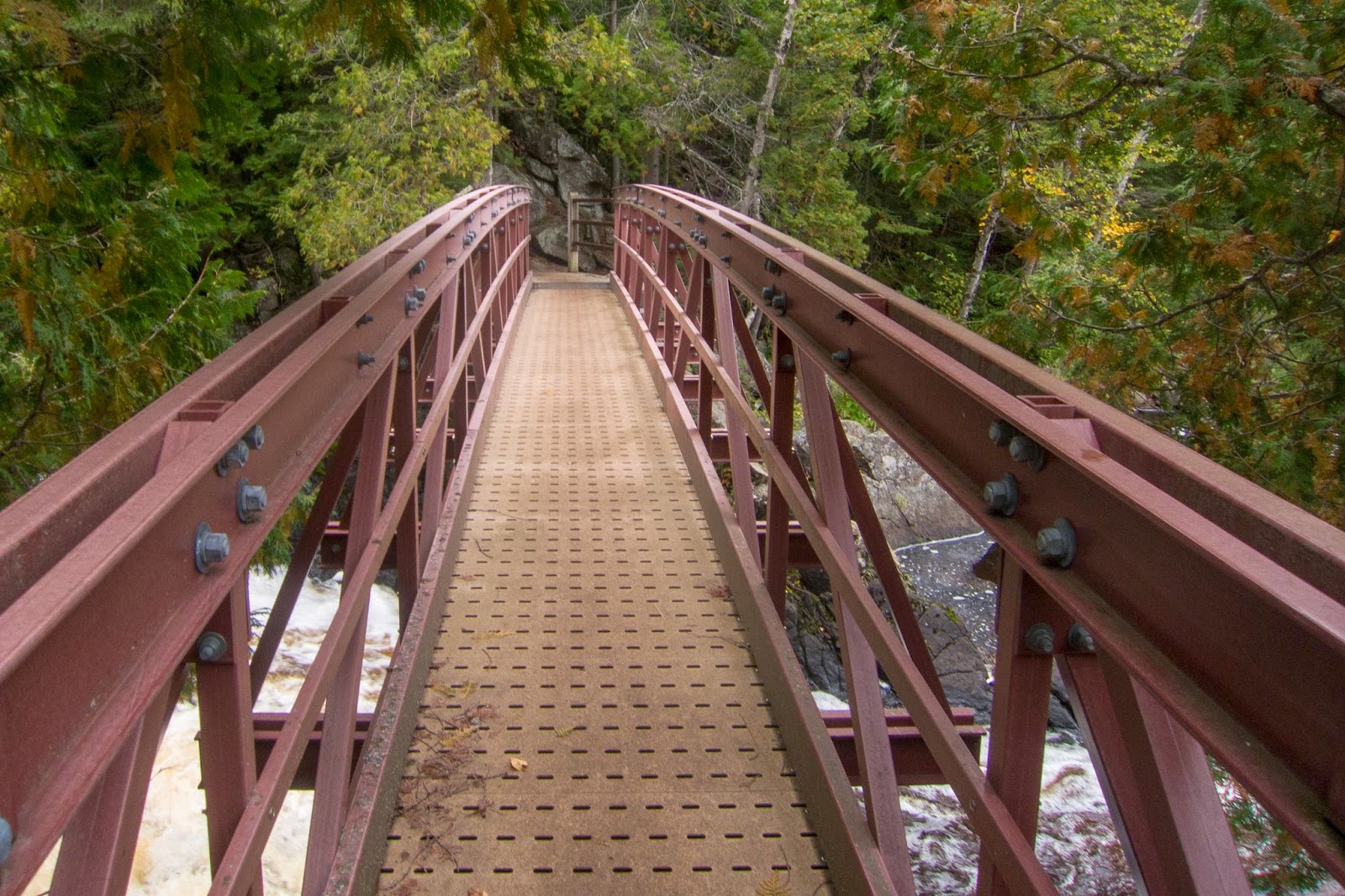
I came to Baptism High Falls, the tallest waterfall entirely in Minnesota (The Pigeon River Falls are higher but also in Canada.)

I crossed a unique bridge and then descended to the base of the falls.


The next section had more impressive views of Lake Superior...

...Moose Lake (Johnson Lake per Google)


...and mountains to the South!

I came to the rocky Sawmill Dome with a view into the valley below.

From Sawmill Dome I headed to Lake Co. Rd. 6 and passed an interesting rock formation.

From the road I climbed up to the Section 13 cliffs for more stunning views!


The was a large group setting up camp nearby.


I descended to Sawmill Pond and its impressive boardwalk.

I could even see some swans in the distance.


The trail passes a huge "glacial erratic" rock.

After a long and beautiful day I made it to Egge Lake.

Day 9: Egge Lake to Fredenberg Creek (26.1+.5+.2= 26.8 miles)
Early the next morning I made my way to Sonju Lake. I met a group of section hikers hiking south. They even took my picture with their camera. Sonju Lake has a boardwalk that leads out to a small island.

The trail followed the scenic East Branch of the Baptism River.

There was foam floating in the river.

The SHT entered a pristine forest.

Next was George H. Crosby-Manitou State Park, a unique park in that it is maintained as a backpackers only park.

I stopped to get some water at the public water access and then took a worthwhile and short side trip to the cascades of the Manitou River.

Crossing the Manitou River

The trail climbed steeply to views of the Manitou River Valley.


The views were plentiful including Lake Superior as well.


I came to a muddy section of trail.

Next I came to the Caribou River. Unfortunately I think I missed the side trip to Caribou Falls.

I don't remember exactly, but may I thought this was the waterfall. Pictures online look more impressive so maybe I just missed it.


I experienced some of the finest views on the way to Crystal Creek. There was a fine birch forest and views of Lake Superior. Also, there was a special covered bridge over the creek.

I took a short break at Crystal Creek Campsite, the only official site with a view of Lake Superior on the trail.

I followed some muddy trail to Alfred's Pond, an interesting bog.


From the pond there was a section of the muddiest trail yet. I thought of camping at the Dyer's Creek Campsite, but continued on in the late evening to Fredenberg Creek. Before arriving there was great view from Tower Overlook. I descended to the campsite and met John and Todd. They were on a section hike and knew a lot about the trail. Todd was just getting into backpacking and John had done a lot of hiking in the Superior area. We stayed up late talking.
Day 10: Fredenberg Creek to West Leveaux (15.3+.5+.3=16.1)
I decided to take it easy the next day and slept in a little. Early in the day I came to the raging Cross River.


I took a break at an awesome campsite right by the river.


The trail followed a scenic ridge on its way to the Temperance River.

While crossing the Temperance River Road, I noticed a black creature in the road. I had to do a double take before I realized that it was a small black bear.
Temperance River

The Temperance River was one of my favorites.

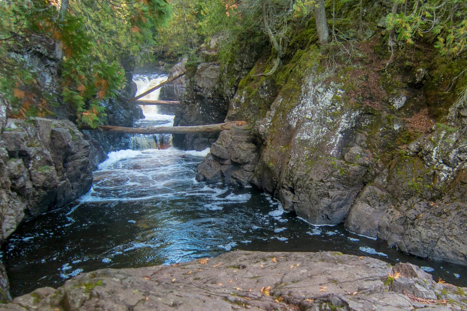
It had many waterfalls as I followed it downstream the its famous gorge.


I took a short side trip to see the gorge and then down to the mouth of the river after crossing the highway.
Temperance River Gorge


Looking out into Lake Superior

Hidden Falls

I returned to the main SHT and continued on the other side of the river. A friendly day-hiker offered to take my picture.


The trail continued along the river for another mile or so.

The trail then climbed up to rewarding views from Carlton Peak, one of the most impressive peaks on the trail.


I met day-hikers Nancy and Jeff at the top. We talked for a little while. Just as they were about the leave the summit. Nancy came over and gave me a huge cookie! Thank you!

As I descended, I caught up to them again. Nancy directed me to their vehicle in the parking lot and gave me even more food. This time fresh apples and half a loaf of banana bread! Thank you so much Nancy and Jeff!

Trail Angel Nancy

I probably should have gone up Britton Peak but I'd already had such a great day that I continued on to the Leveaux Campsites.

I set up camp at West Leveaux and had a scenic evening view of a beaver pond.

Day 11: West Leveaux to Indian Camp Creek(21.2+1.8=23.0)
I began the day with some banana bread and an apple!

I again opted to pass up a scenic spur trail. This time it was the Leveaux Mountain trail. One trail that I couldn't miss was next: the Oberg Mountain Loop. It has at least eight different view points and is certainly a can't miss spur on a thru-hike. The first view was back to Leveax Mountain (maybe Carlton Peak in the distance?).

I then came to a great view of Lake Superior.


It was still early in the morning and the sun lit up the trees.
Its rays shown down on the great lake.


I had some of the farthest views to the North yet.

There were great inland views as well!

The overlook of Oberg Lake was special.

Looking to Moose Mountain

Oberg Lake

Oberg Lake and inland ridges


There were more mountain views to come. Next up was Moose Mountain with a great view back to Oberg Mountain.


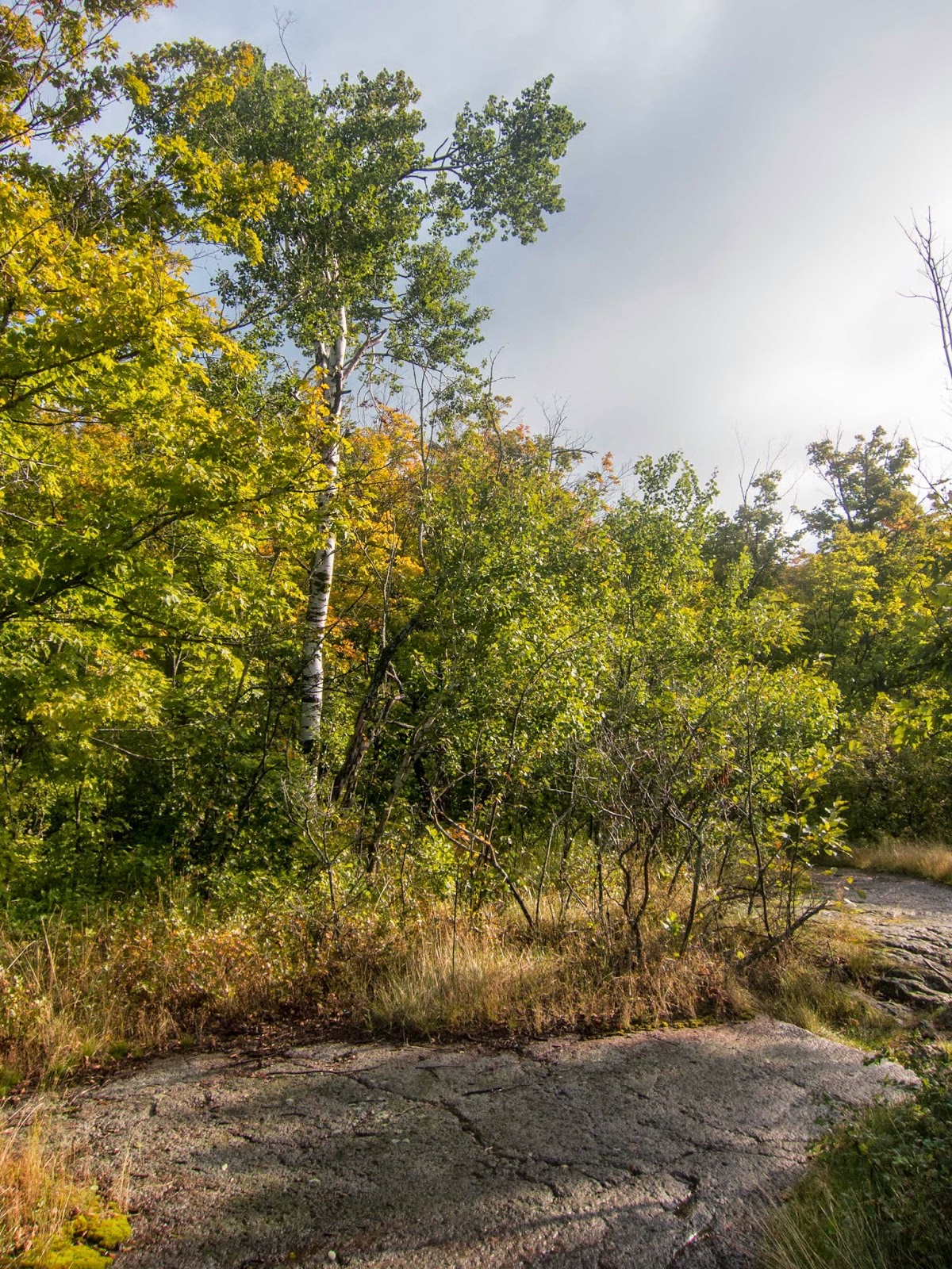
Then it was on to the beautifully forested Mystery Mountain. There was another small overlook. The fall colors were starting to come out quite well!


I came to the Poplar River bridge near the Lutsen Ski area.


The trail climbed up to the ridge overlooking the Poplar River Valley. I met another backpacker, Andrew, who was out for a long distance hike. He had lost his phone, so I let him borrow mine for him to call his family. He was a nice guy and offered me some nutella!

We came to one of my favorite views on the trail of the Poplar River meandering far below.

Poplar River

Andrew and I came to one of the best lakes on the trail, Lake Agnes.

We climbed about to an impressive overlook above the lake.


There was a trail register at Hunters Rock where I learned that it was Andrew's birthday after reading his entry. I wished him Happy Birthday. What a great spot to celebrate a special day!

Andrew decided to set up camp at the lake. There was a southbound thruhiker setting up camp as well. I was quite tempted to stay but needed to make it to Grand Marais the next day.

I hiked through a camp's property and had a nice view of Caribou Lake.

I came to a nice pond near Jonvick Creek.

The trail again climbed up to more ridgeline interior views.


Superior views were present as well.


Grand Marais was visible far to the north.

I had the Indian Camp Creek Campsite all to myself and enjoyed a starry night.

Day 12: Indian Camp Creek to Grand Marais (18.9+1.7+1.2= 21.8)
After entering Cascade River State Park, I enjoyed a great morning view from Lookout Mountain!

I hiked down the famous "96 steps" to see the west side of the Cascade River.

Back on the trail I found this impressive waterfall. I believe it may be called Hidden Falls.

Then I started to get to the famous cascades. I stayed closest to the river to make sure I didn't miss anything.


The Cascades made this river one of my favorites on the trail.


There was a spot where a bridge was out over a creek, but there was no water flowing, only a special cairn to mark the way.

The trail left the river for some time and then became very rugged and steep. It then descended back to the river.

I passed another waterfall along the river.

After taking a short break on the benches by the North Cascade River Campsite, the trail left the river and then I came to what I believe is a view of Eagle Mountain, the tallest mountain in Minnesota.

The SHT then rejoined the North Shore State Trail (NSST) for the first time in many miles. It was still quite similar: a wide snowmobile trail with few views and some muddy areas. There were some nice flowers though, but overall this stretch wasn't all that exciting.

The SHT left the NSST and came to an overlook above Grand Marais.

I came to the Gunflint Trail and headed down to Grand Marais. I had left a package at Lund's Motel on the way to Isle Royale so I stayed there again. It wasn't that close to town, but was reasonably close to the Gunflint Ranger Station. I needed to stop in and get permits for the Boundary Waters Wilderness Area the next morning for my hike on the Border Route and Kekekabic Trails.
My favorite baseball team, the Detroit Tigers, just happened to be playing the Minnesota Twins so the game was televised. I went and ordered a huge 16" pizza from Sven and Ole's. I ate the entire thing. In the morning after getting my permit, I went to the Pie Place Cafe for a huge breakfast including a massive omelet, three blueberry pancakes, potato casserole, toast, and orange juice. I purchased some scones to eat on the trail and picked up a few additional snacks at a local gas station.
The Harbor in Grand Marais


Good for you Pal so proud of you. Why don't you just keep it to yourself. We don't need crowds up here
ReplyDeleteThanks for reading! Beautiful area!
DeleteMoissanite tennis bracelets are beautiful. moissanite tennis bracelet
ReplyDelete