September 2, 2015
For entire Wind River Route report begin here: http://ericshikes.blogspot.com/p/wind-river-high-route.html
We awoke to a blue, nearly cloudless, sky.
It was pleasant hiking on our way to Glacier Lake (Lake 10555').
Next was Long Lake (Lake 10683').
We hiked on the east (left) side.
There was some talus, but it wasn't bad.
We climbed up on a ridge and enjoyed the view.
Looking back at Long Lake
We enjoyed beautiful cross country hiking on our way to Europe Canyon.
Then took a break at Lake 10542' and examined our next climb.
Looking north from inlet into Lake 10542'.
Before our climb there was some talus on the lake's eastern shore.
Soon we were high above the lake with a great view of Europe Canyon.
It was a great view from the top of the small pass.
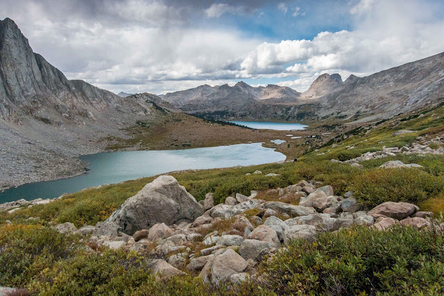
Looking south we could see Lake 10806'.
We were a little more careful with route finding on our way to Halls Lake.
We passed a green stream.
At Halls Lake we enjoyed a great view of Halls Mountain and the Continental Divide.
There was a trail as we left the lake.
Then we went cross country on our way to Middle Fork Lake.
There was a scenic pond on the way.
At Middle Fork Lake we took a break before joining an excellent trail on our way to Lee Lake.
Middle Fork Lake
The scenery was impressive including Nylon and Pronghorn Peaks.
There was a great view from Lee Lake. We considered setting up camp, but it was still early in the day. We decided to continue to Bonneville Basin.
Lee Lake
We met a couple hikers near Lee Lake who were planning to camp for the night and hike into Bonneville Basin the next day. We began our climb up as many dark clouds loomed overhead.
Looking back to Lee and Middle Fork Lakes
We reached an upper basin and turned toward Donna Lake and continued our climb.
At Donna Lake we enjoyed a dramatic view of Pronghorn Peak. The dark clouds had moved along.
Looking back with Donna, Lee, and Middle Fork Lakes
We continued up from Donna Lake to the pass between Peaks 11865' and 11925'.
At the pass there was a great view of Lake 10828' and the Bonneville Basin.
The descent was somewhat tricky with many ledges and cliffs. We were able to find a use trail/route that worked well.
Looking back to the pass
We decided to set up camp at Lake 10828' and enjoyed a relaxing evening with many views!
Looking up Bonneville Basin
It was an excellent spot to camp.
There was some great evening light.
It was another spectacular day on the Wind River High Route. We enjoyed the numerous views, pleasant weather, and relatively easy hiking.
Continue to Day 6: Upper Bonneville Lake to Shadow Lake


No comments:
Post a Comment