January 17-18, 2020
17+ miles roundtrip
Within the last year the North Fork Trail has had trail maintenance and is now possible to hike all the way to the Kentucky Falls Trail. At 17+ miles roundtrip, this is one of the best overnight adventures near the Oregon Coast. It includes beautiful forest and three of the coast's best waterfalls. I decided to try fast packing for the first time which is combing trail running and backpacking.
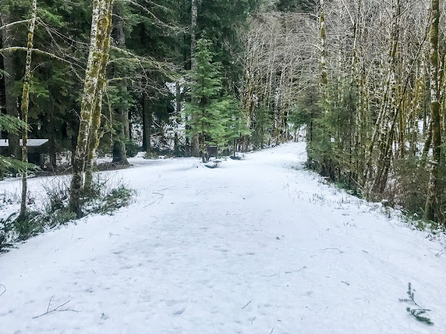
After working a half day on Friday, I arrived at the North Fork Trailhead and found there was snow. I added some extra clothes to my Osprey Talon 18 pack that was already nearly filled to capacity. It wasn't snowing, but actually raining.
North Fork Trailhead
There was a sign with distances on a large tree.
I planned to run about 7 miles to Kentucky falls and hopefully find a campsite nearby.
The forest was special.
There were many bridges along the trail.
I reached a bridge over the North Fork of the Smith River.
This might be the bridge that was recently installed.
The trail was great for running and I found the weight of my loaded backpack didn't slow me down too much.
The trail was up on a ridge and I could see the river down below.
I came to another bridge crossing back over the North Fork of the Smith River.
It was still pretty wet out and phone was getting wet, making unlocking my phone to take pictures challenging.
There were many small waterfalls beside the trail.
There was a giant Douglas Fir Tree
Another small waterfall
I made it to a spot where the trail was covered in snow and slippery as neared many waterfalls.
As I neared the big waterfalls, the trail descended to the North Fork of the Smith River. I believe there were a few campsites in this area.
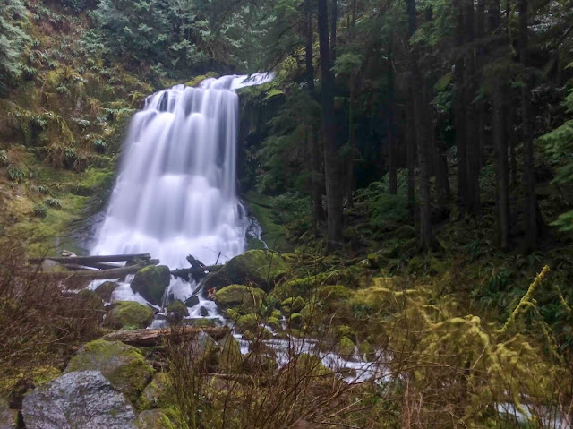
Soon I was at the waterfalls. North Fork Falls is on the left and Lower Kentucky Falls is on the right.
North Fork and Lower Kentucky Falls
Lower Kentucky Falls
North Fork Falls
The trail switchbacked up from the falls and at the top of the ridge there was a great campsite. It was almost seven miles from where I started and it had taken me a little less than two hours. I was soaked and quickly changed into some warm clothes and ate some food.
It rained some throughout the night, but I stayed dry. In the morning I left my gear at camp and ran up to the Kentucky Falls Trailhead.
Kentucky Creek
The trail was up on a ridge above the creek.
I reached the final large waterfall: Upper Kentucky Falls.
Upper Kentucky Falls
The Kentucky Falls Trailhead was snowed in.
Kentucky Falls Trailhead
I turned around and started my journey back to camp.
Upper Kentucky Falls
Back at camp, it took me a little time to pack everything into my small backpack.
All packed and ready to go!
I returned to North Fork and Lower Kentucky Falls
Lower Kentucky Falls
North Fork and Lower Kentucky Falls
North Fork Falls
North Fork of Smith River
The snow had completely melted from where it covered the trail the day before.
Back at the Douglas Fir
North Fork of Smith River
As I neared the trailhead, there was a small loop trailhead that I decided to explore.
I made it back to the trailhead.
I stopped near a bridge on the North Fork of the Smith River to cook some warm food.
Mashed Potatoes
Overall, this was an awesome adventure. I really enjoyed the chance to try fastpacking, and the scenery of this area was exceptional. This is classic Oregon with forests and waterfalls. I didn't see any other hikers, but it was a cold and rainy/snowy January weekend.


No comments:
Post a Comment