~10 miles
During the night I heard loons on Beaver Pond down below. I awoke to a cloudy morning.
The remainder of the route mainly parallels Trout River Pond.
There were some views hidden in the clouds, but it was a pleasant morning.
At times visibility would improve and I could see ponds and plan my route in advance.
There was an impressive gulch in the distance.
It even had a waterfall.
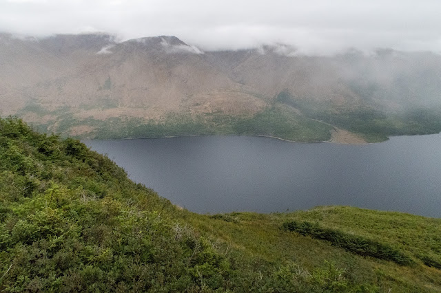
I could also see the fog coming off Trout River Pond and the Tablelands.
I headed for an overlook of Trout River Pond through some tuckamore.
I discovered a broken sign on the ground indicating the Gros Morne National Park Boundary.
There was a good view of the Big Trout River Pond and the Tablelands.
Through the fog I could barely see the Narrows and the Small Pond.
I could see one of several impressive gulches on the Tablelands.
I continued along the route.
Sometimes I had to plan ahead as the brush can get quite thick in places. Sometimes there were no alternatives to push through.
I found a cabin that hadn't been finished yet.
Then I made my way back to Trout River Pond.
I came to a view of Trout River Small Pond and could see all the way to the ocean.
Trout River Pond Narrows
Visibility was improving and I could see the impressive Tablelands quite well.
I reached Narrows Head and the hike was almost complete.
I had to be careful with the descent as it is quite steep and descending straight down what is called the Elephant would be quite challenging. The route skirts around to the side and I found three moose staring at me.
I navigated carefully following a gps track.
I descended steeply through the forest without any sign of a trail.
Looking back at the first part of the descent
Looking to the Elephant
Tablelands and Elephant
I came to a point where it was indicated that the route descended but it was still quite steep.
There was lots of loose rock and I descended carefully to the river below.
Looking back up at the descent
After reaching the river at the bottom, I probably should have followed the route a little more carefully as I ended up having a serious 1000 foot bushwhack through very thick forest to reach a dirt road. In one spot I lost my sunglasses off my head and took my pack off while looking for them. See the pack in the forest below. Probably would be best to scout out more open areas while descending from the Elephant to avoid getting stuck in this area.
After reaching remote roads, it was an easy walk to the end of the route.
The community of Trout River was visible in the distance.
Looking back to the Elephant
Tablelands and Elephant
I had arranged for my parents to pick me up. When I reached the main road (still unpaved) to Trout River, I turned right and continued that way as they weren't there yet. I hoped they hadn't gone past the pick up point. We had arranged a backup plan to meet at the post office in town. Soon I saw their vehicle and my hike on the UltramaTrex was complete. There were some nice views as we drove to Trout River.
Overall, this was one of the most spectacular hikes that I have completed. It was a great experience for the second annual hike with my brother. The diversity of scenery and wildlife is exceptional. While traversing this remote region we didn't see anyone else while hiking the route. Also, there was an abundance of water and we did not need to filter it.
Many thanks to the IAT and Paul Wylezol for all hard work on the trail and assistance to help complete this incredible route.


